*This was written about a year ago when I first heard that the club was floating the idea of trip reports. It’s not a club trip, just a fun solo trip that I thought was worthy of a write-up. Yes it ended up turning into a bit of a novel*
9th – 18th Jan 2025
I first heard about Ivory Lake while spending a rain day stuck inside a hut on the Dusky Track in Fiordland. In the hut was a book called “TROG”, a collection of trip logs from the Canterbury University Tramping Club. With nothing better to do, I read it cover to cover. Ivory Lake Hut, “the best backcountry hut in the world” abounded with tales of wild weather, gnarly alpine scrambles, relentless boulder hopping up flooded rivers, and failed attempts to reach it. I put it on my list there and then for if I was ever back in NZ.
Exactly one year later I find myself alone in Wanaka. After an epic 10 day canyoning trip, the crew have returned to Australia, while I decided to extend my stay with the intention of getting to Ivory Lake.
With a few days to kill, I message some workmates who are also travelling NZ to see what they’re up to. They ask if I want to join them tomorrow for a 4 day tramp in Arthurs Pass. Hmm, I very much do, but I’m all the way down south in Wanaka, and it’s going to be tight to squeeze in both tramps and still get back to my flight in Queenstown on time… especially when I’m relying on hitchhiking.
“Sure I’d love to join you guys” I reply
Righto, tomorrow’s mission. Hitchhike from Wanaka to the trailhead near Arthurs Pass, then hike the 15km into West Harper Hut to meet them. I’d also need to stop in Arthurs Pass Village where we’d be finishing the walk so I could stash my bag of unneeded canyoning gear. Surely it’s fine to just stash it off the trail in the bush right? I did the maths… it was close to $2000 worth of gear in that backpack, I guess I’ll just stash it a long way in the bush. With all that in mind, I had no idea if I was even going to make it to Arthurs in a day. It is a 7 hour drive without stops according to Google Maps.
Hitching in NZ proved incredibly easy, after 3 rides I found myself thumb out by the side of the road in Franz Josef, when out of nowhere it started pissing down. Rain can work to the hitchhiker’s advantage, drivers are more likely to feel sorry for you… for about 5 minutes that is, until you look like a drowned rat.
I got lucky. A driver in a parked car hailed me over
“Where you headed?” asked the driver, whose name was Mo
“Arthurs Pass” I replied
“We can get you there” said Mo
Amazing, I’m actually going to make it!
Only problem was Mo’s car already has four people in it and is chock-full of luggage. Next thing I know Mo’s on the phone speaking in another language, some cars that have just driven past suddenly U-turn and pull in next to us. Mo then jumps out of his car, walks to the middle of the road and starts flagging down more passing cars, which promptly pull over.
Turns out 25 members of an Iranian family who had recently immigrated to New Zealand, were driving home to Christchurch in a six car convoy after their first ever camping trip. With a bit of shuffling between the six cars we were able to fit in my luggage and myself. Thanks so much to Mo, Amir, and the whole family for your help! These legends even insisted on waiting for me at Arthurs Pass Village while I stashed my unneeded gear, and then dropped me right off at the trailhead. I really wish hitchhiking was more common in Australia so that I could return the favour.
Anyway, 15km later I arrived 10:30pm at West Harper Hut. The others were asleep in a tent. I fell asleep in the dingy looking hut and figured I’d surprise them in the morning.
The next 4 days were pretty straightforward tramping. We ticked off Bealey Hut, West Harper Hut, Hamilton Hut, Cass Saddle Hut, Hawdon Hut, Edwards Hut, and arrived back in Arthurs Pass Village where my workmates headed back to Christchurch for their flight home. I collected my canyoning gear and set up camp next to the visitors centre.
Onto the main event.
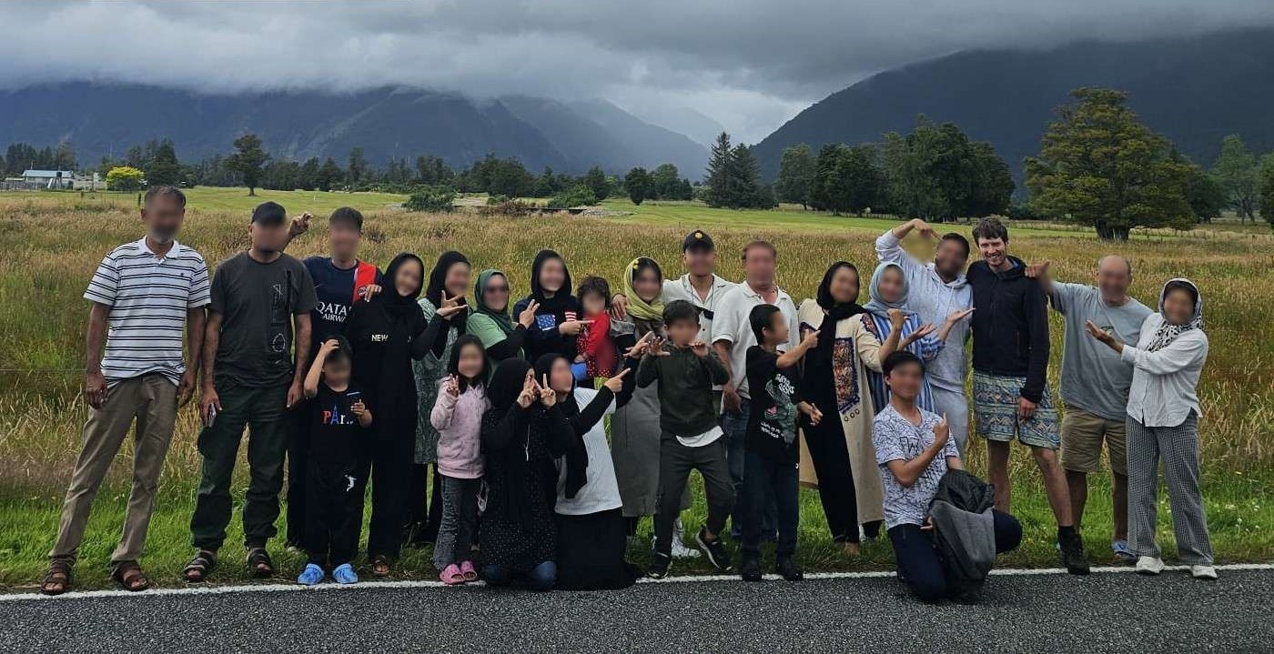
Mo and the family
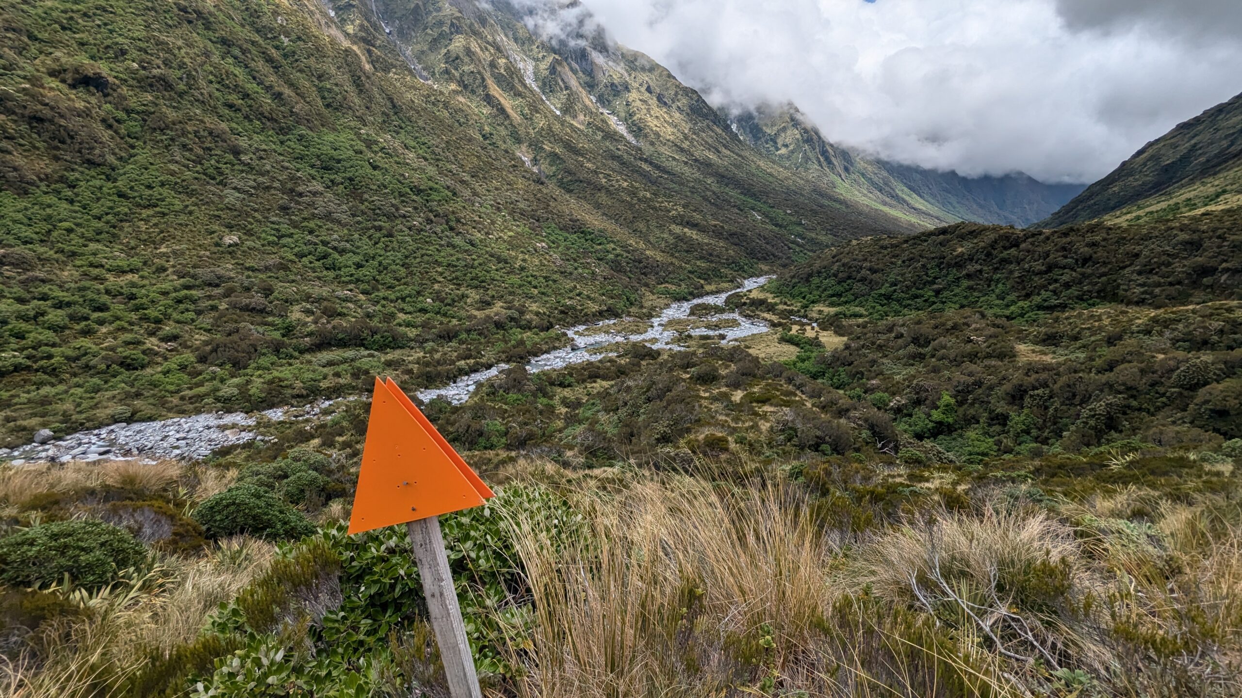
Day 1: Hokitika Gorge to Explorer Hut – 12km
For this tramp I’d decided to do a loop walk starting and finishing at Hokitika Gorge. This is a tourist hotspot that gets pretty busy and should be easy enough to hitch in and out of. As a bonus mission in addition to getting to Ivory Lake, I wanted to see how many backcountry huts I could visit, so had sketched out a bit of a longer route than strictly necessary in order to bag some extra huts.
I’d planned for 6 days, but would carry one extra day of food in case of bad weather, or if the trail was tougher than expected. I don’t know what my plan was if both these things happened simultaneously.
That morning I hitched from Arthurs to Hokitika, quickly grabbed 7 days of groceries, and braced myself for what would be the toughest part of the day. Walking 3km to the edge of town for a good hitchhiking location. At that point I had my hiking pack on my back, my canyon pack on my front and a shopping bag full of food in my hand, totalling about 40kg. It was a slog, but necessary to get past the local traffic. Soon enough I had a ride to Hoki Gorge.
A fun fact I learned while exploring Hoki Gorge. The Cropp River rain gauge which is just 10km away holds pretty much all the NZ rainfall records.
- 134mm in 1 hour
- 758mm in 24 hours
- 16,617mm in a calendar year
When it rains here it rains hard. There are many tales of people getting stuck in huts for days waiting for rivers to recede. Even the most innocuous looking side streams can become uncrossable after heavy rain. Fortunately the forecast was looking pretty good.
This story also features a guest appearance by UTSOAC Club Member Linus, who just happened to be at Hoki Gorge as I was prepping to leave. Always strange to see a familiar face while in another country.
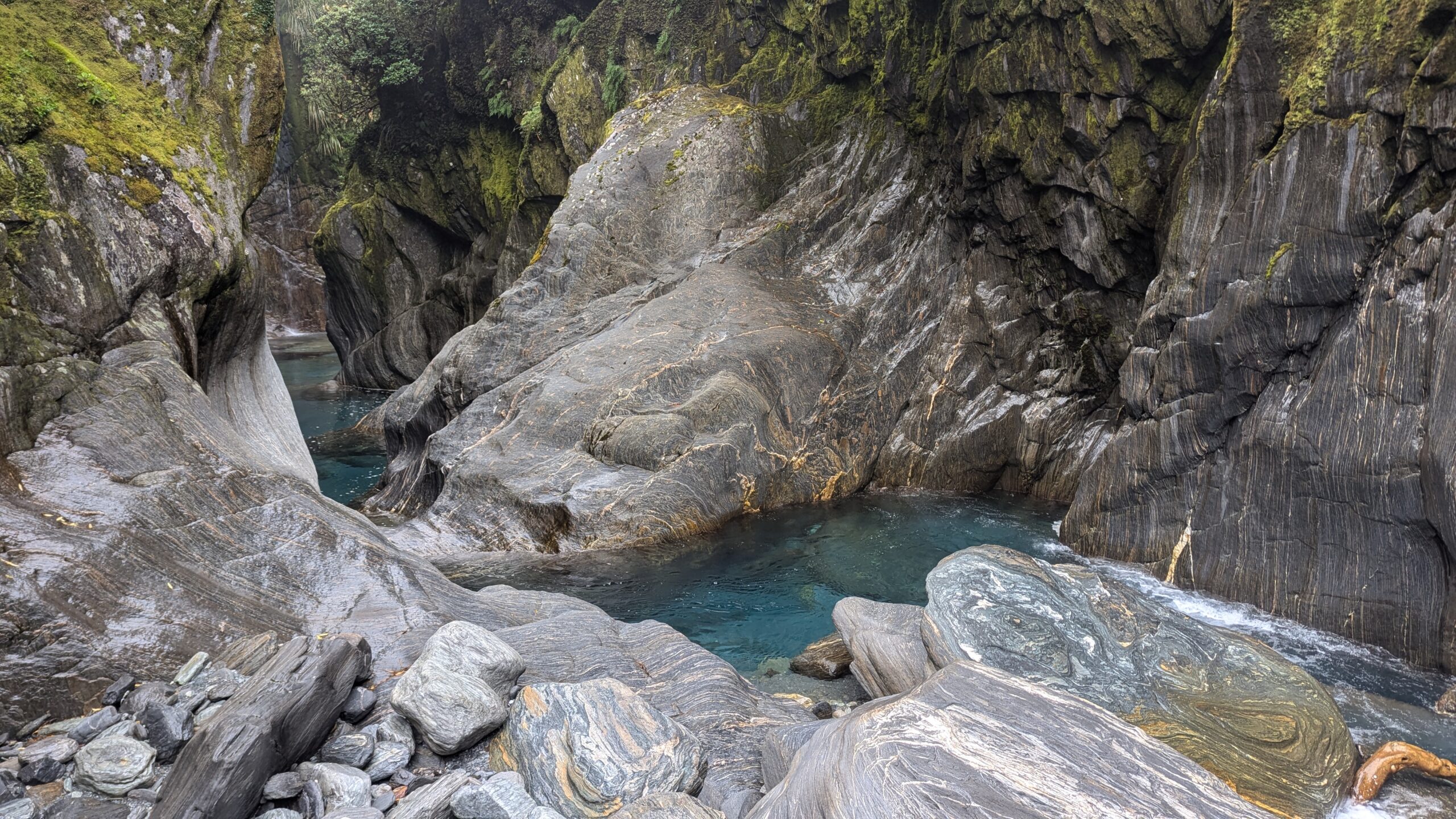
The view from Hokitika Gorge Swing Bridge
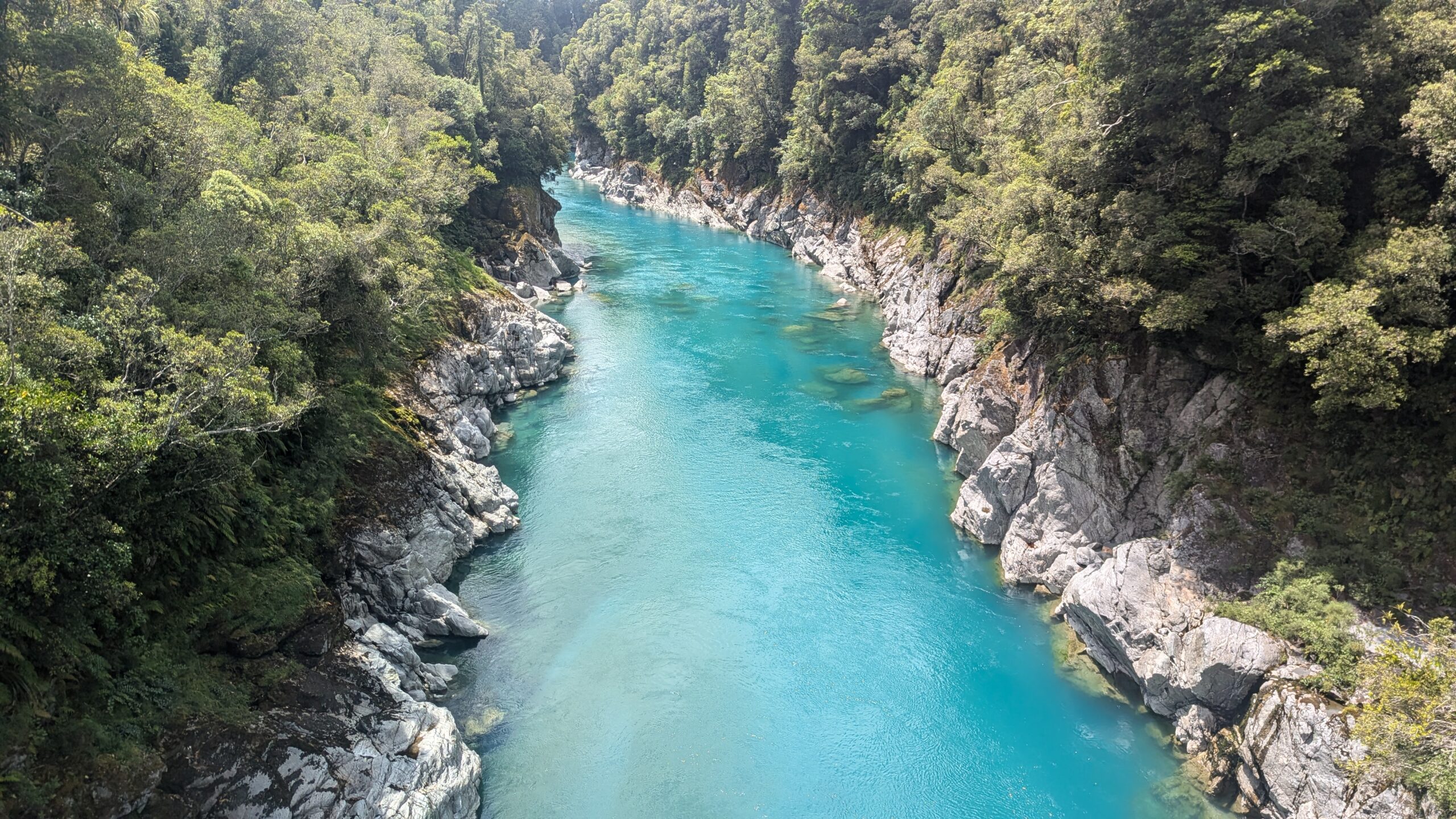
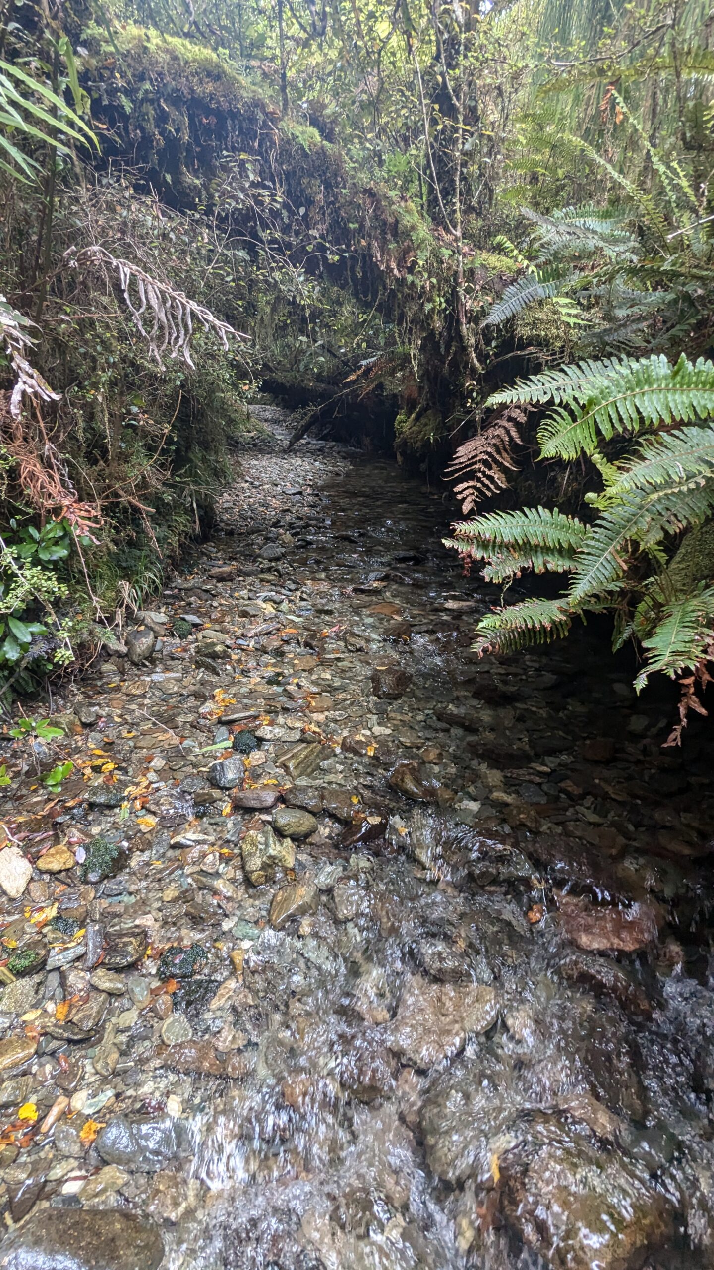
Within a few hundred meters of crossing the swing bridge and turning off the tourist track, I began to feel like I was in proper wilderness. Walking along the banks of the Hokitika River I stopped for a swim in its turquoise blue waters before powering uphill through the west coast rainforest to Minnow Creek. The route from here to Explorer Hut seemed like it had been recently cleared. It was easy to follow and frequently marked with Permolat. Wherever practical though, the route would just follow creeks. Wet feet are inevitable in New Zealand if you want to get anywhere quickly. A good chunk of the day was spent wading up Minnow Creek and Doctor Creek. In Australia, this place would have been swarming with leeches.
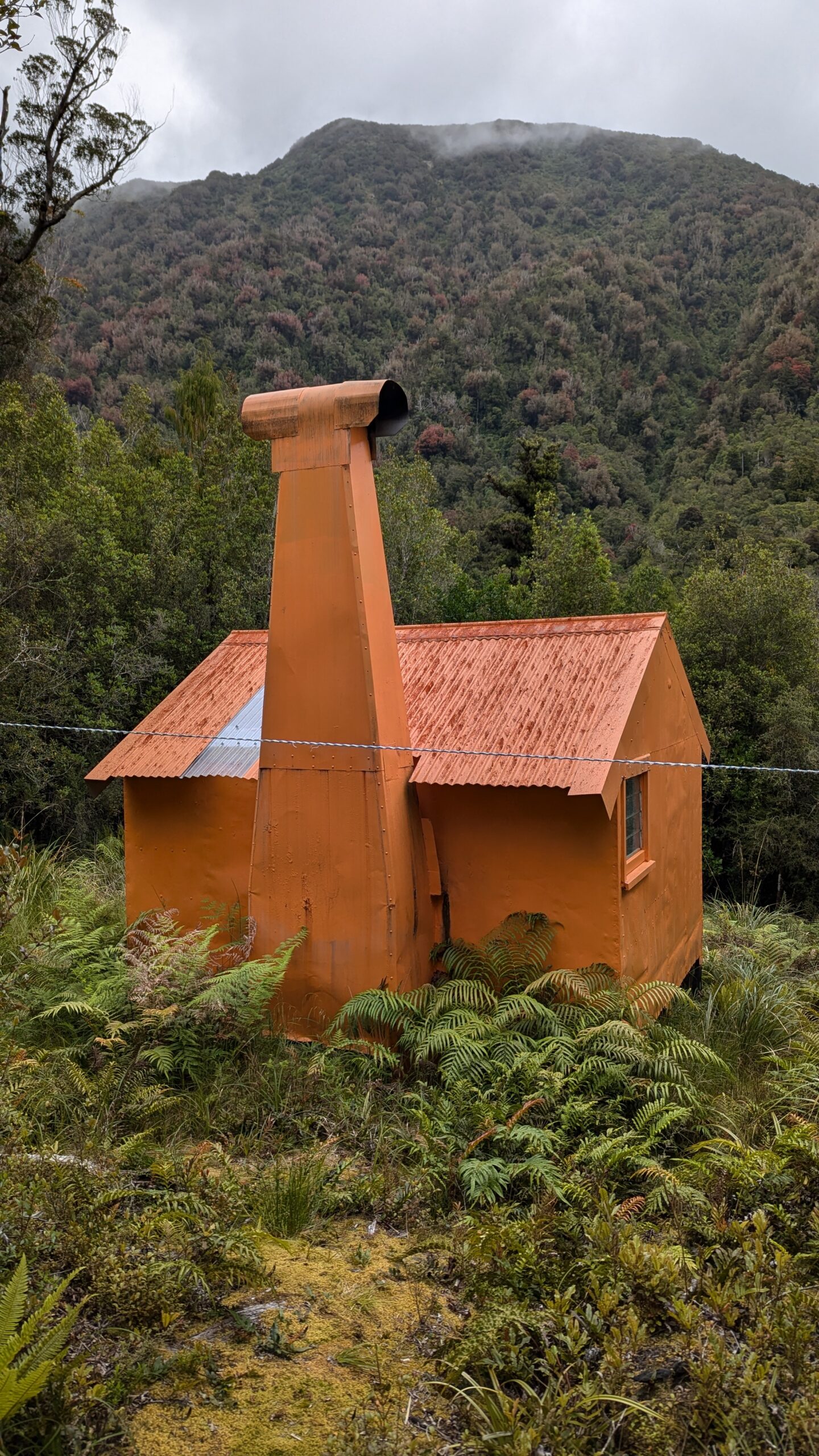
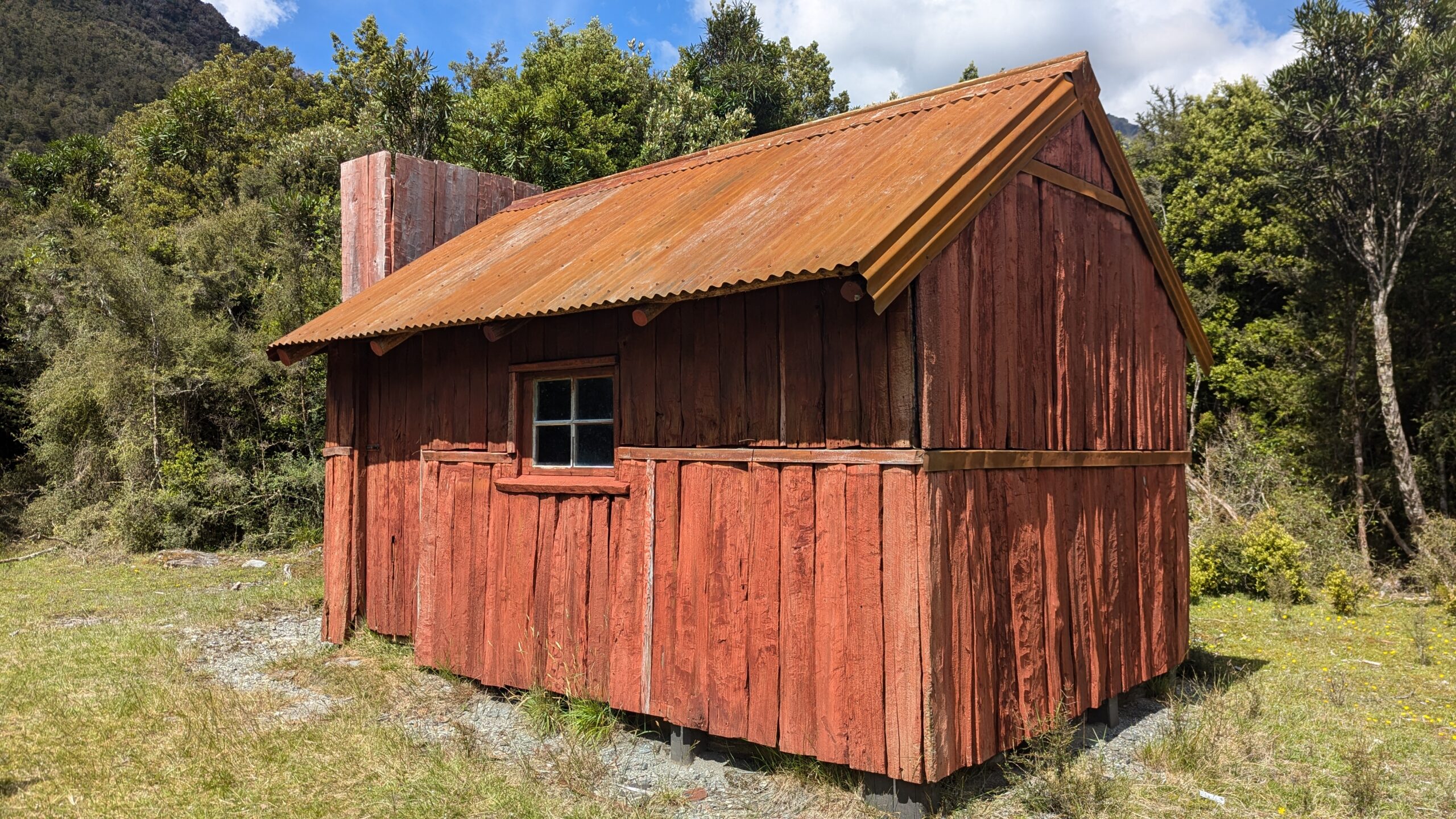
Smith Gorge was a highlight, where the creek flows through a deep canyon, and a trail takes you up and around on the true right. Soon enough I arrived at Explorer Hut, a little beacon of orange tucked away in the vibrantly green rainforest. Perfect timing, it had just started drizzling. Turns out the mozzies also appreciated having somewhere dry to shelter, the open fireplace giving them easy access to the interior of the hut. Oh well, give me mozzies over sandflies any day.
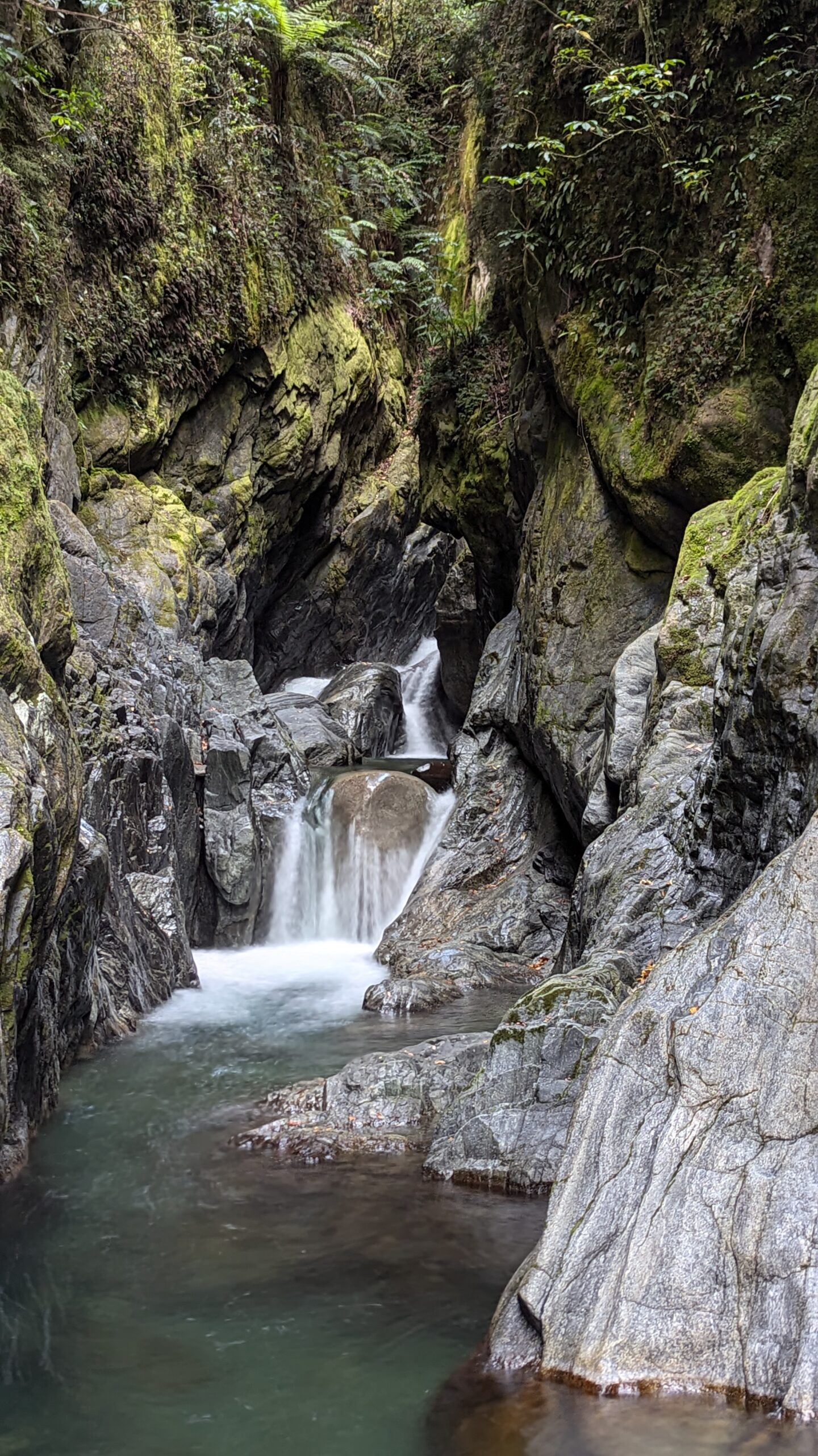
Smith Gorge
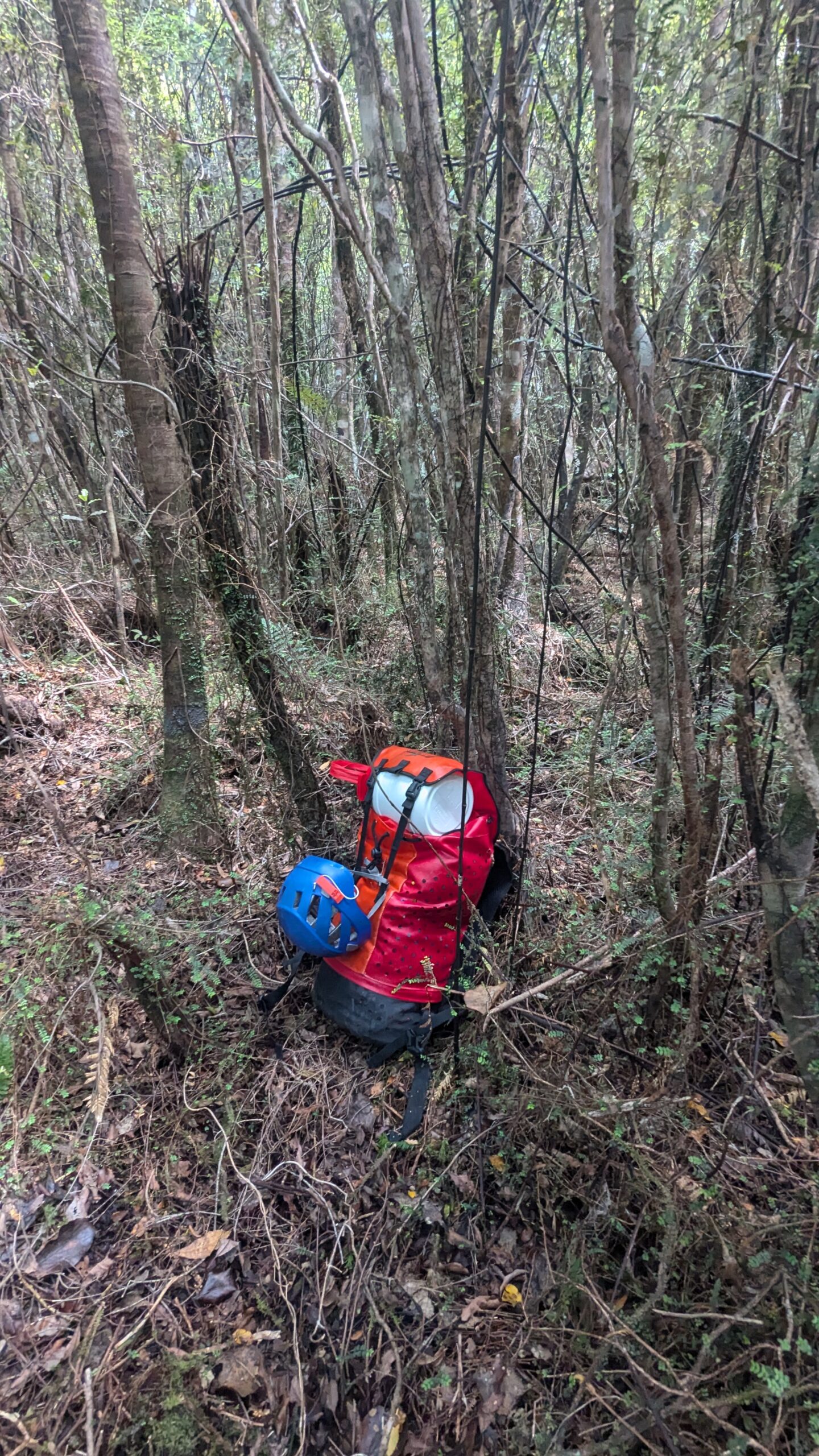
My well hidden canyon pack at Hokitika Gorge
Wading up Minnow Creek
Explorer Hut
Day 2: Explorer Hut to Dickie Spur Hut – 11km
The plan for today was ambitious; I wanted to get all the way to Top Tuke Hut. Only 16km but with some big ups and downs, and tough terrain. Boulder hopping down the Mikonui River was slow going, and involved one unplanned swim. Where the creek gorged up I had the option of attempting a slippery boulder problem with a deep water belay, or alternatively bush-bashing up around the gorge. I mean, there was probably a trail to bypass this section, but I didn’t really check…
Anyway, you know which option I chose, and you know exactly what happened.
Waterproof your gear folks!
Once I’d reached the flats, travel was easy all the way to Mikonui Flat Hut, which I could see was occupied, based on the boots and walking poles left out front. Sandflies were out now so I quickly got inside the hut for a snack. Turns out the residents were also Aussies, but what I was most surprised by were the musical instruments they were carrying, which looked sort of like six string ukuleles.
“What are those?” I ask, “Cause they’re not ukes, and they’re not guitars?”
“Oh those are our guitaleles, or some people call them ukitars”
Yeah, literally just a guitar ukulele fusion. Pretty neat instrument to take backpacking.
Mikonui Flat Hut
Crossing the Tuke River before climbing Dickie Spur
From here it’s about 1200m ascent to the tops where I’d find Dickie Spur Hut and planned to have some lunch. There was a well formed trail, but it was steep, muddy, and rough terrain, clambering up tree roots in a light drizzle which only seemed to get heavier the further I ascend.
I find the scale of the terrain here hard to wrap my head around. Part of it is that I’m used to looking at 10m contour intervals on the maps back home, over here the topos are all 20m intervals. What looks like a tiny gully on the map will present itself in reality as a deep gorge with fast flowing water. What looks like a clean well-defined spur line, will devolve into some gnarly knife edge ridge filled with all sorts of difficult to navigate bluffs and bumpy bits. The vegetation over here is also as much a part of the terrain as the rocks and soil.
Back to the point I’m trying to make though, which is that climbing up to Dickie Spur took quite a while. I didn’t get to the tops until about 3:00. My plan had been to stop at the hut for lunch, then continue another 4-5 hours to Top Tuke Hut. That was still an option, but I knew full well in this rainy weather that if I entered a hut I wouldn’t be leaving till morning, handing the burden of covering distance over to future Toby
Oh well, future Toby can just deal with it, I was soaking wet, hungry, couldn’t see anything through the clouds, and just wanted a hut.
It was a full house at Dickie Spur that night. I was joined by a local named Dave (I think that was his name), and the two guitalele toting Aussies. Dave was a wealth of knowledge regarding the huts and trails in this area, and the Aussies proved to be talented musicians. I really enjoyed listening to them play.
Climbing up to Dickie Spur
Dickie Spur Hut
Day 3: Dickie Spur Hut to Ivory Lake Hut – 13km
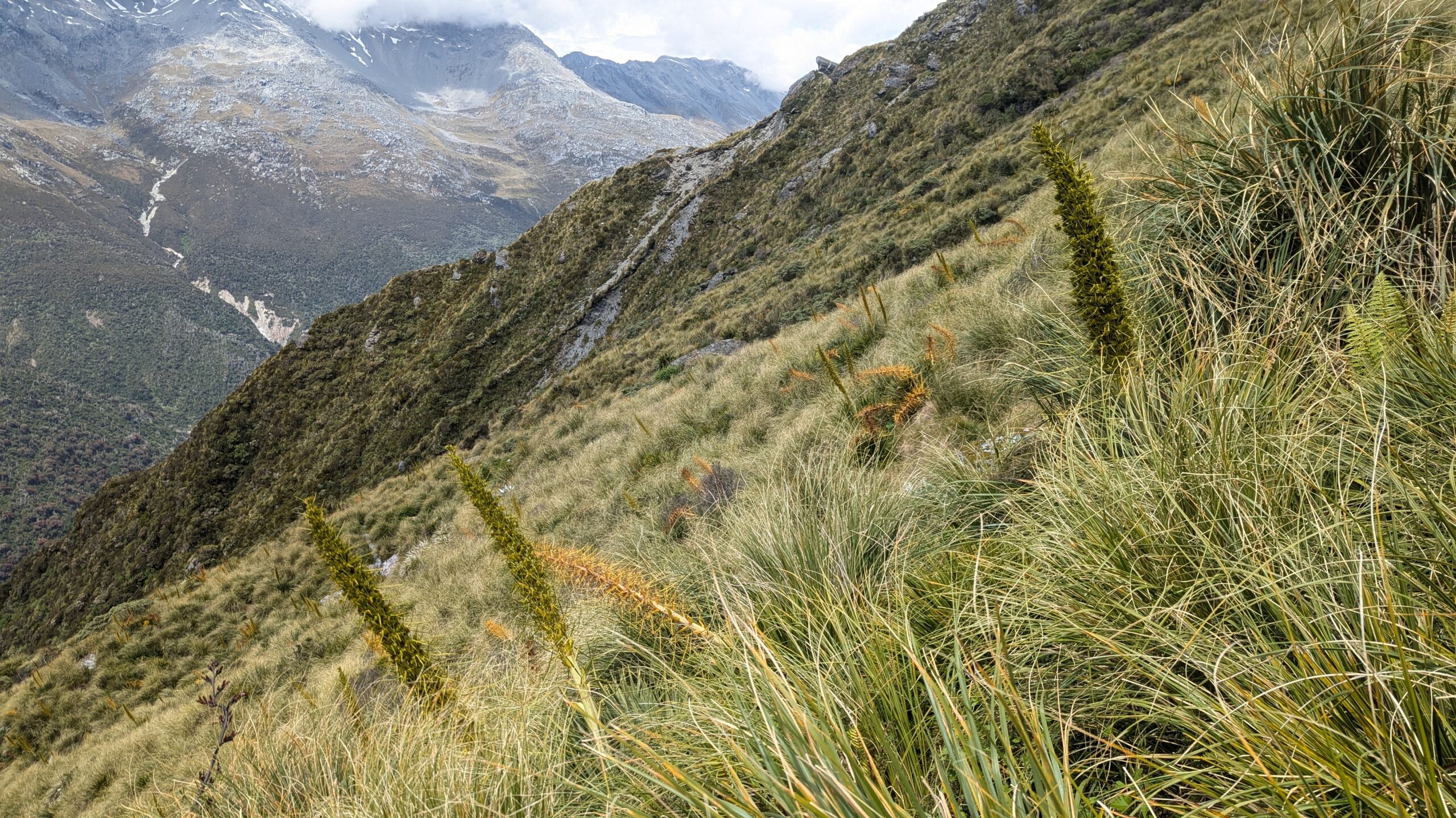
It was tomorrow, and I was now future Toby. The weather seemed to be improving so I set my sights on Ivory Lake; it was going to be a big day. There are two options for getting to Ivory Lake from here. Option A is to head back down to the Tuke River, follow the river upstream to Top Tuke Hut, climb up Mt Beaumont and follow the tops around till you can descend to Ivory Lake. Option B is to stay on the tops the whole way and traverse the aptly named Sawtooth Ridge. The major benefit of Option B is that it avoids a massive 1100m ascent and a whole lot of boulder hopping. The major downside of Option B is that it sounds like it gets into some seriously spicy terrain requiring an ice axe and possibly crampons for which I had neither the skills nor equipment. Option A it was.
Dickie Spur
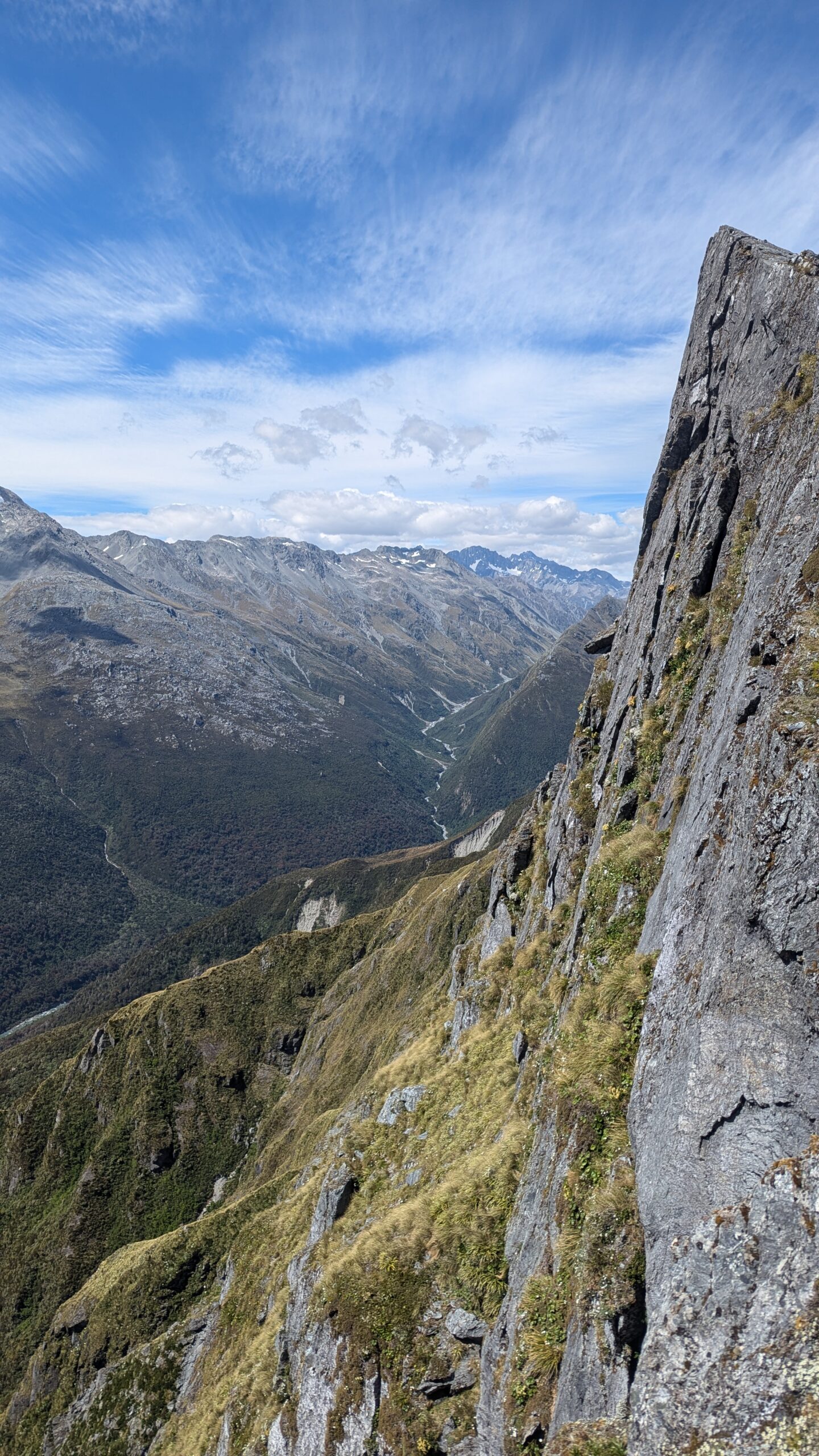
On the descent down to the Tuke the clouds began to lift giving me the first actual views of the trip. I could see my route up the valley, but Mt. Beaumont and the tops remained shrouded in mist.
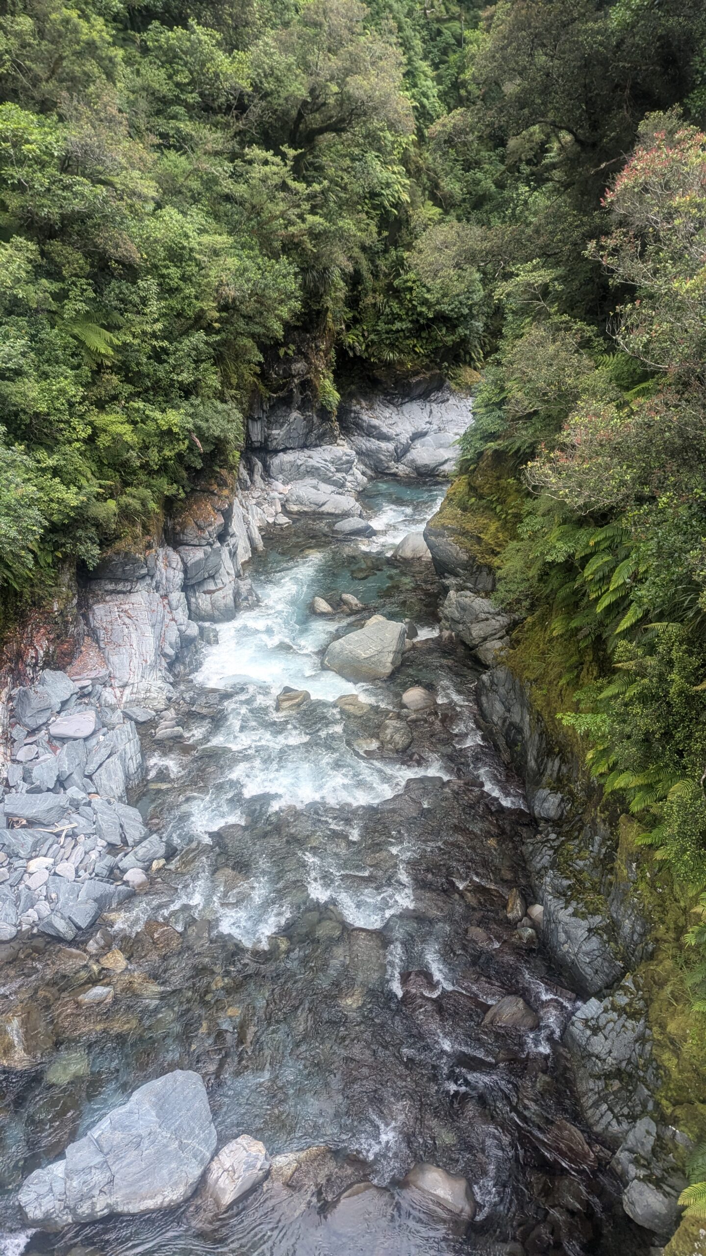
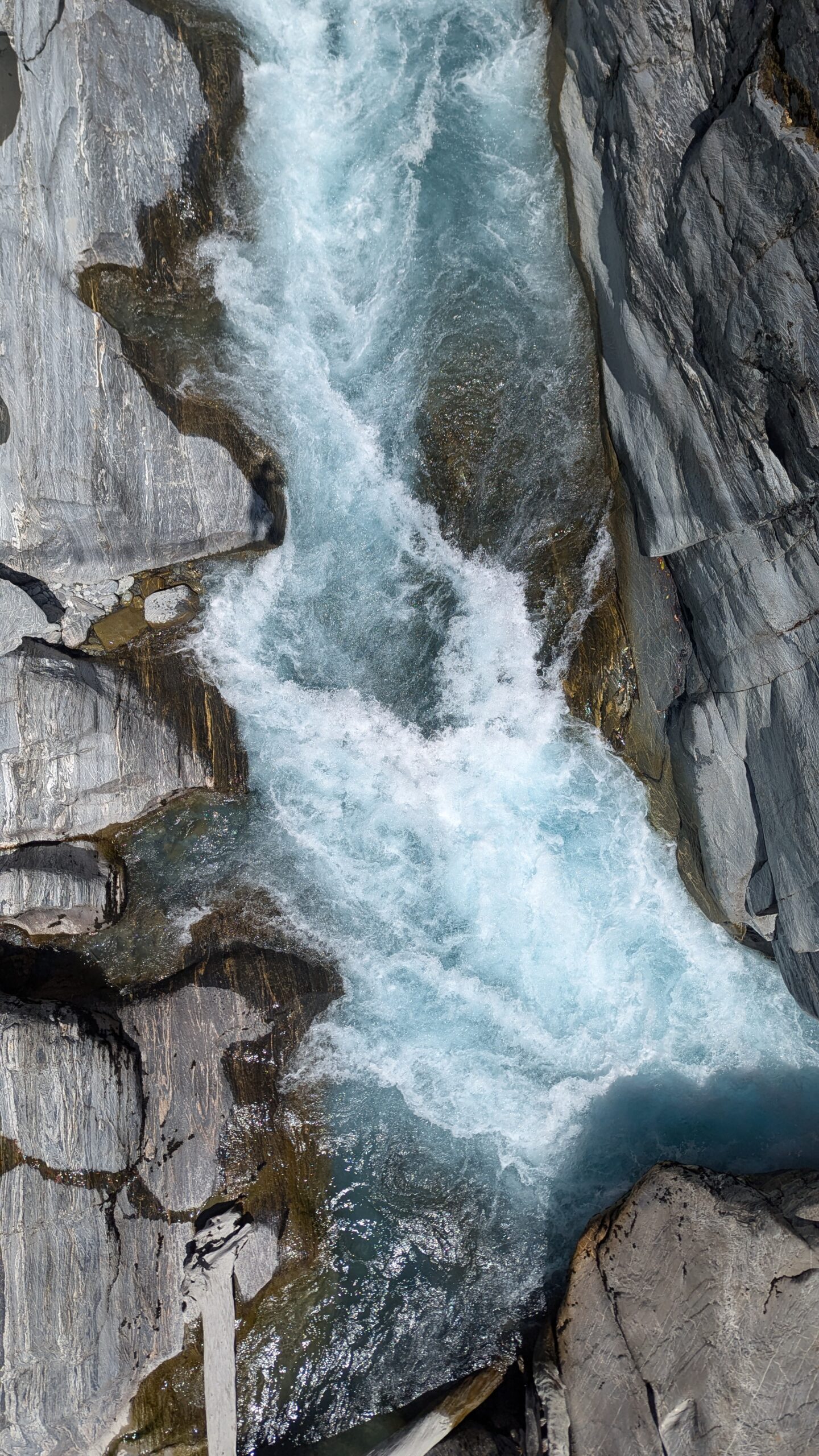
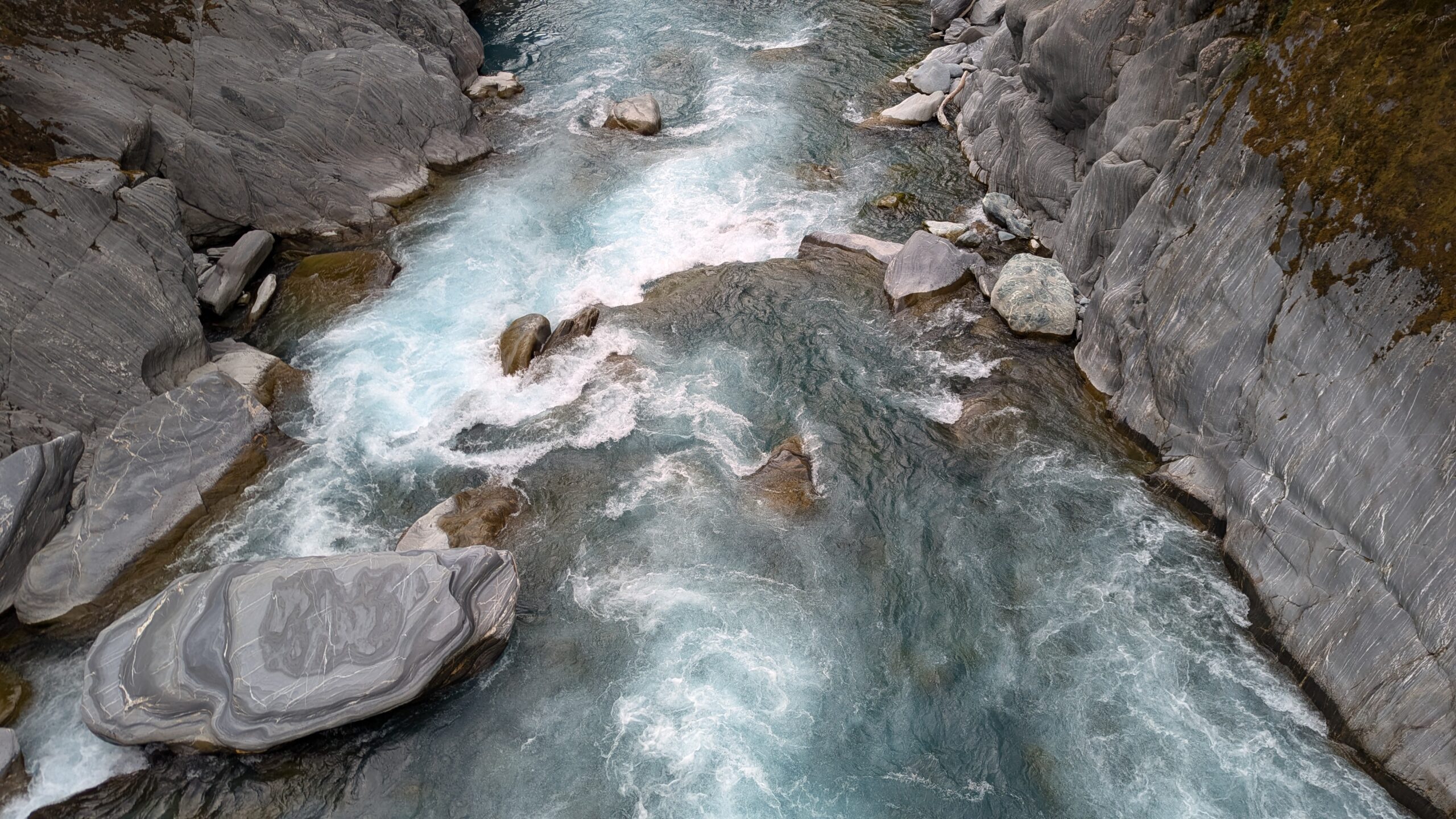
Finally down at the river, I find myself staring downstream into the entrance of the Tuke River Gorge. This gorge has a bit of a legendary status for both canyoners and kayakers alike. It’s only been descended once and has an estimated grade of v5a6IV****.
“The Tuke is a major undertaking, life-threatening for expert teams of canyoners even in ideal conditions.
The first descent was done at the end of one of the longest, driest summers that most locals can remember….
‘Normal’ flows are likely to be much higher.”
There’s enough water flowing down the Tuke right now that even at its widest, flattest sections it would be a challenge to cross. I couldn’t comprehend being in a steep inescapable constriction with this much flow. Fortunately I was heading upstream away from the almost certainly lethal gorge.
Entrance to the v5a6IV**** Tuke River Gorge
This gully is the descent route off Dickie Spur. The Upper Tuke River can just be seen through the clouds
.
The next 3km up to Top Tuke Hut was constant boulder hopping and scrambling, with the boulders getting progressively more house-sized the further upstream you get. Whenever the river feels too tricky to follow, you can bet that there’ll be a little bypass trail wrapping around through the bush. There were many amazing swimming holes dotted along the Tuke, but there was no time for relaxing today.
Soon enough I was at Top Tuke Hut, ready to begin the climb up to Mount Beaumont. It was here that I had my first, but unfortunately not last encounter, with Spaniards…
Do much bushbashing in Australia and you’ll quickly learn that we’ve got no shortage of plants that want to cause you harm. Traversing through spiky vegetation is a learned skill that I hold proud, but at the same time wish I never had to use. I was pleasantly surprised then, that the bush in NZ seemed to be polar opposite to our hostile Australian scrub. Just like the birds here, the plants don’t appear to have evolved any defence mechanisms, and to top it off the whole forest is often lined with a spongy layer of moss, which gently cushions your slips, trips, and falls. Turns out I was wrong, the flora of New Zealand has in fact spec’d all of its defence points into a single plant; Aciphylla horrida, AKA the Horrid Spaniard.
If you hadn’t deduced it from the name, the Horrid Spaniard is indeed horrid. The Spaniard is an ambush predator that feeds on the blood of unsuspecting trampers. It lives in alpine areas where it likes to hide beneath the tussocks, its rigid, needle sharp leaves at the perfect height to stab you on that exposed section of skin between your gaiters and your shorts. Sometimes they flower, a tall yellow stem rising up above the snow grass clearly signalling its location. Don’t be fooled, this is a trap, intended to lull you into a false sense of security. For every flowering Spaniard, there are another ten that lay concealed. These plants are the botanical equivalent of the New Zealand Sandfly, more on them later.
Top Tuke Hut
At 2100m, the (almost) summit of Mt. Beaumont would be my high point of the trip. This was now proper alpine terrain; I’d ascended through the clouds back into that persistent drizzle. No Spaniards up here, just rocks and snow. Step-kicking my way up a low-angle snow slope I think back to a one week old entry that I’d just read in the Top Tuke Hut Book. “Crampons and ice axe are probably not necessary but are recommended as it would be very easy to find yourself in steep terrain by mistake”. In this low visibility, I could see how that might happen. The snow was soft though, and I was somewhat confident I could stop a slide even on a moderately angled slope.
Ascending Mount Beaumont
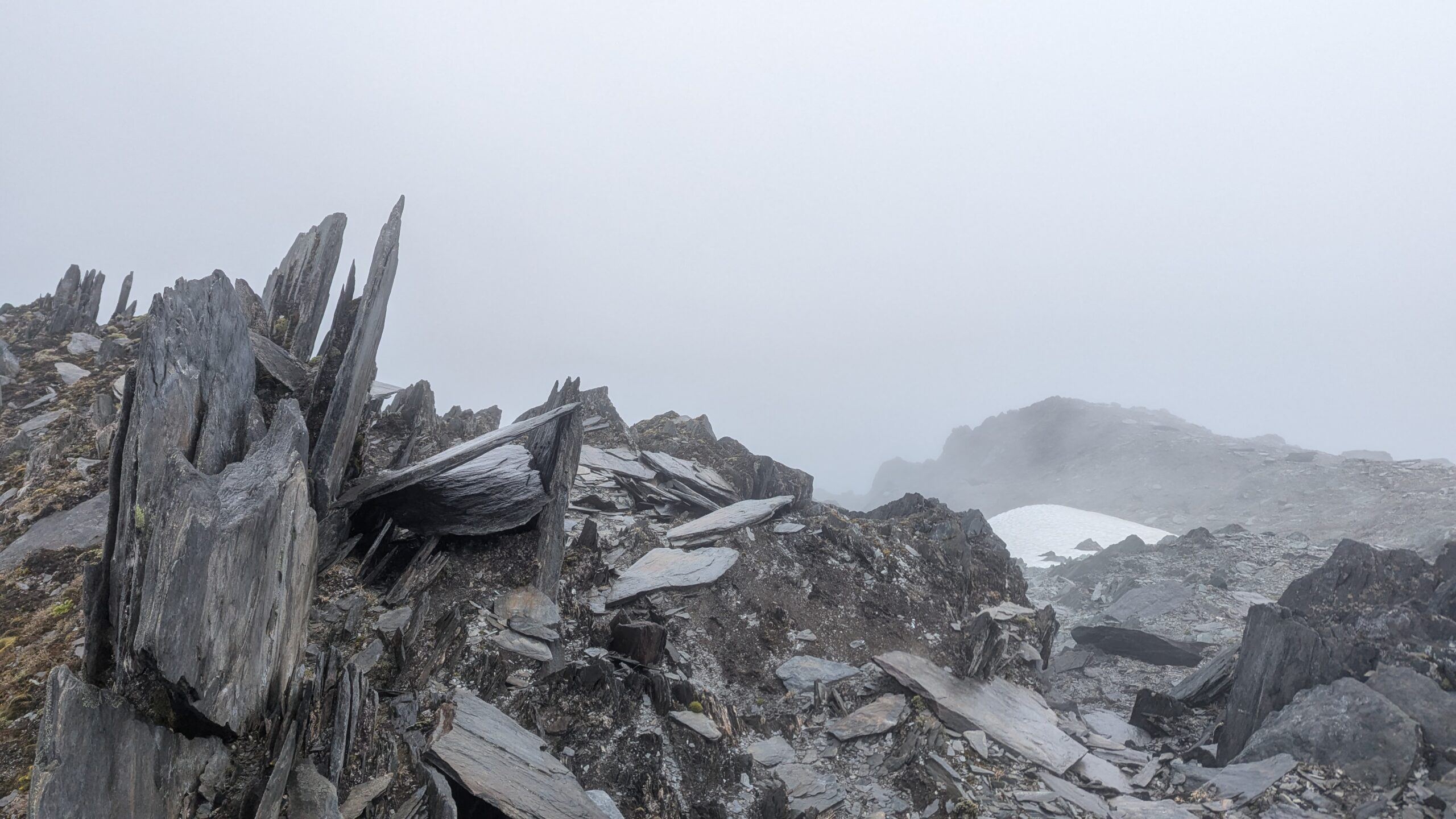
For the most part travel up here was along easy broad ridges, which were very fast in comparison to the rest of the walk. It wasn’t completely without obstacles though; at a steep notch in the ridge line I encountered the fabled weet-bix rocks.
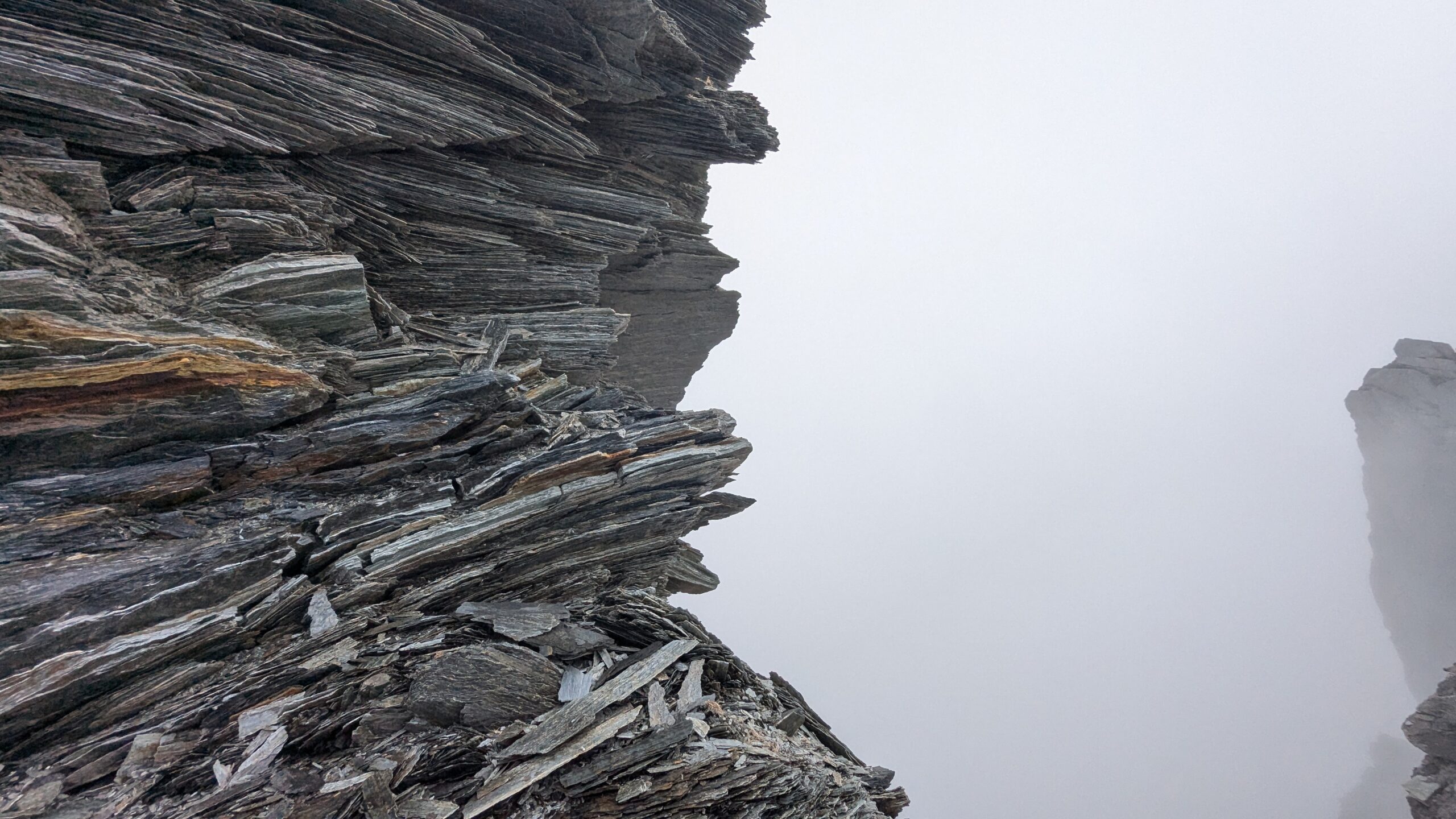
Every trip report I read about this area compared the rocks up here to weet-bix, and now looking at them with my own eyes, I could see why. The rocks were made up of loosely connected, paper thin layers that could flake off with the lightest touch. These flaked off rocks would cover the ground, making everything very slippery, and having much the same effect as leaf litter. It’s a wonder these mountains are still standing, the rate at which they must be eroding.
A fixed hand line had been rigged to assist with the down climb, I didn’t end up using the hand line, finding what I believe was an easier (or at least shorter and lower consequence) downclimb instead. Not a technically challenging scramble, but definitely unnerving climbing around on rocks as flaky as these.
Weet-bix Rocks
A sketchy downclimb with fixed handline
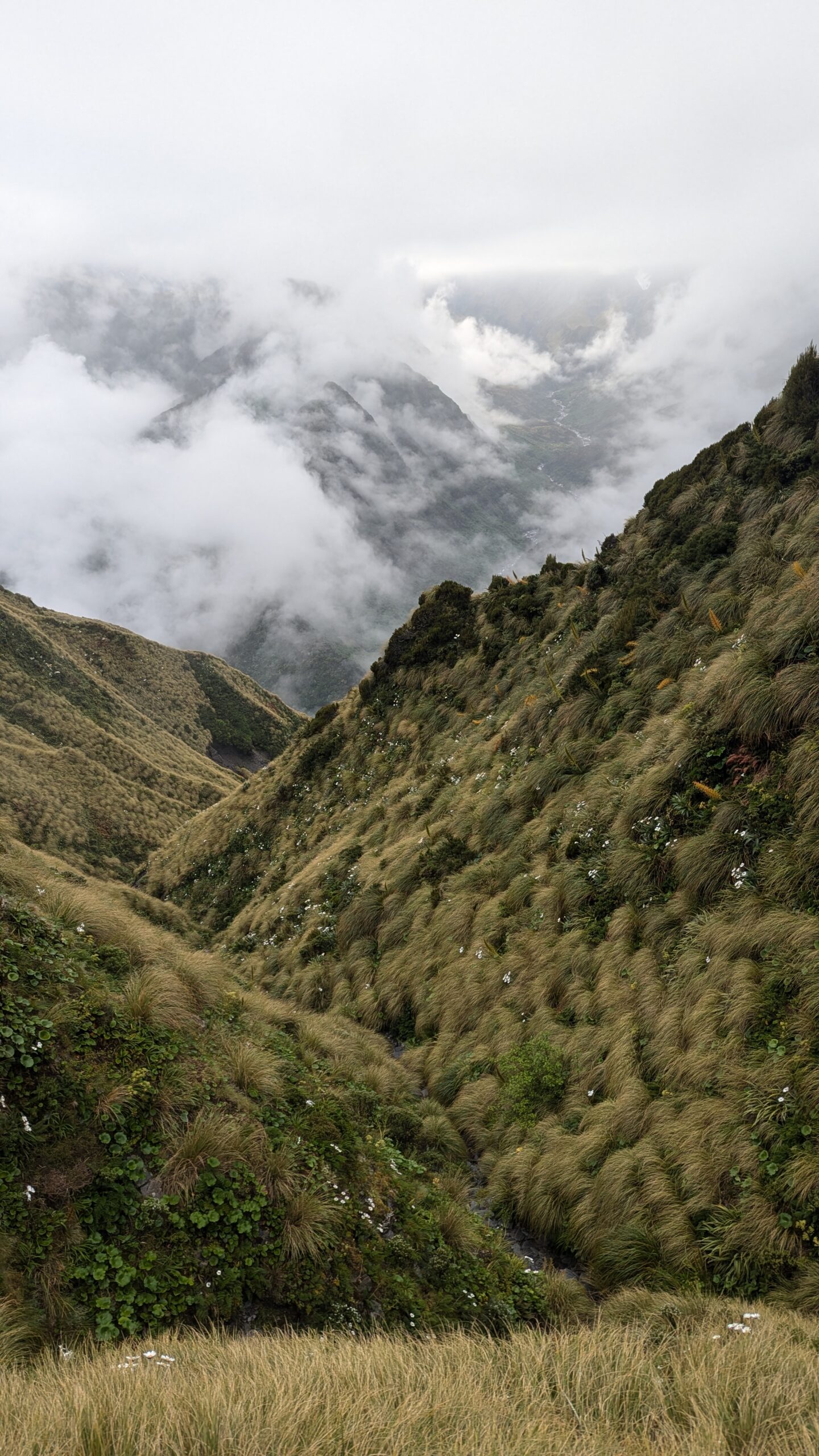
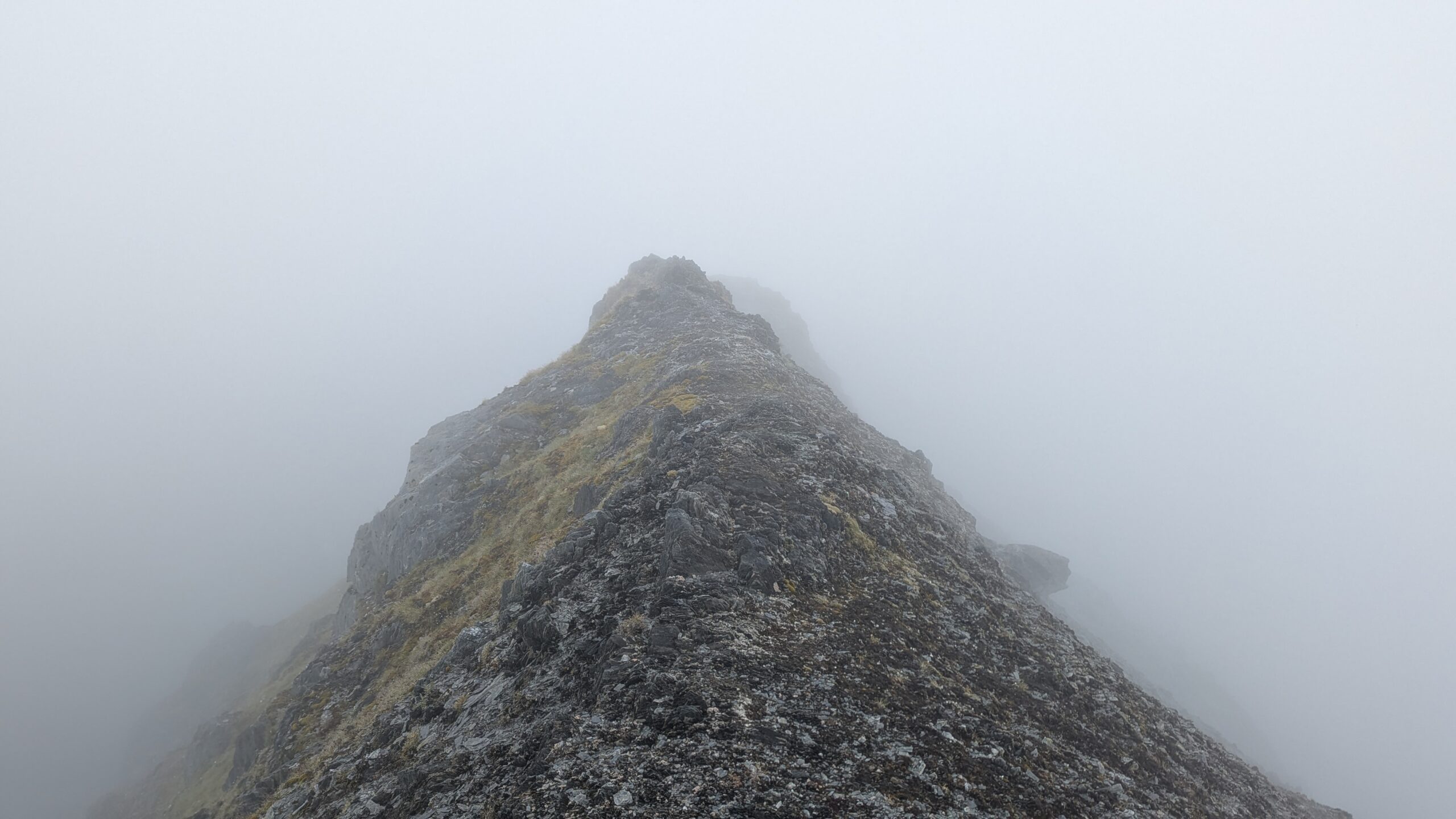
Around this point visibility improved. The clouds began to grow patchy, providing brief windows through to the surrounding peaks.
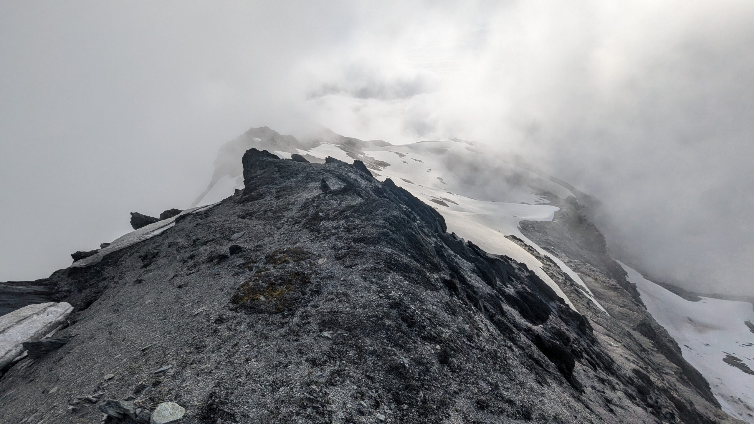
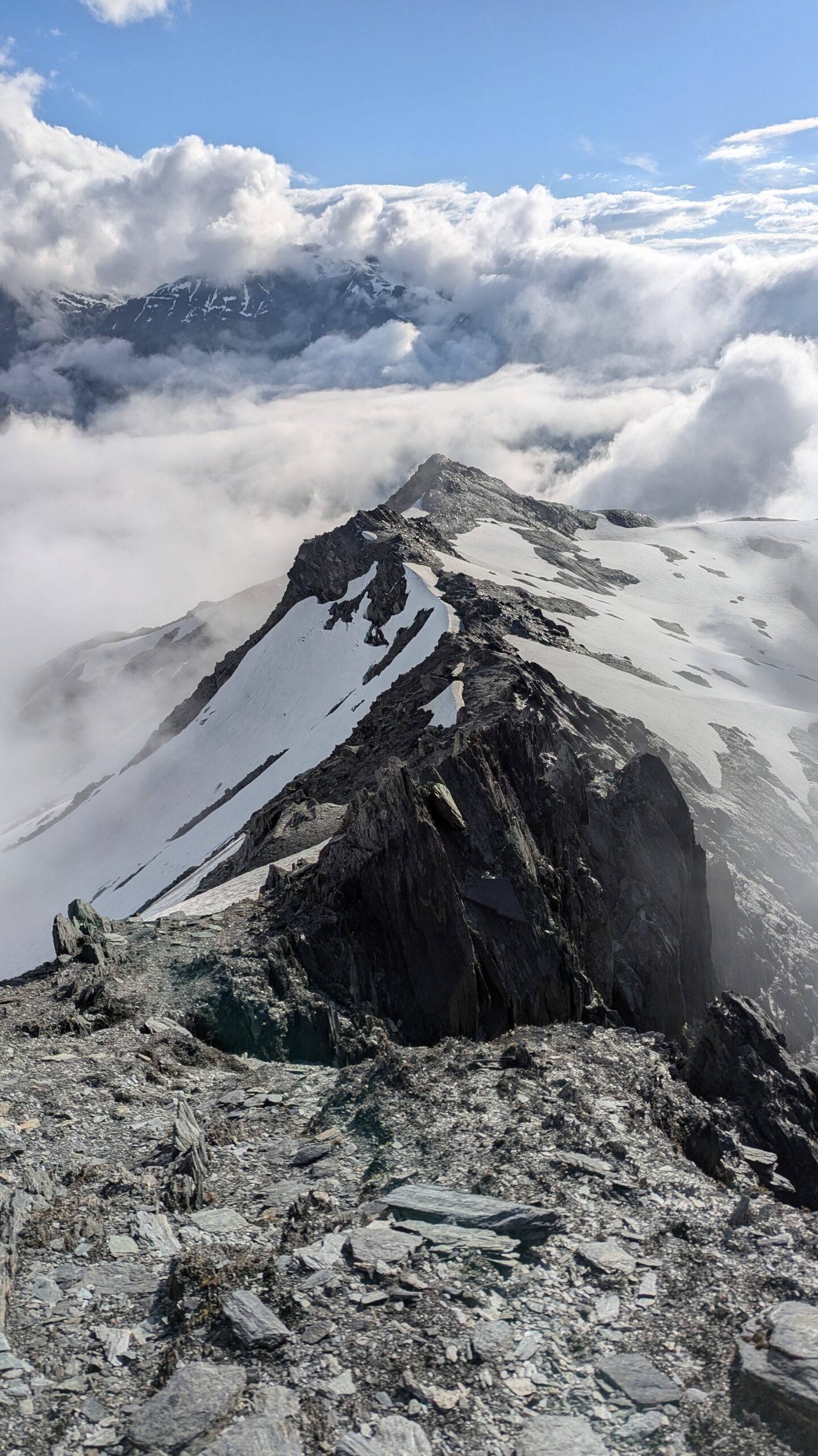
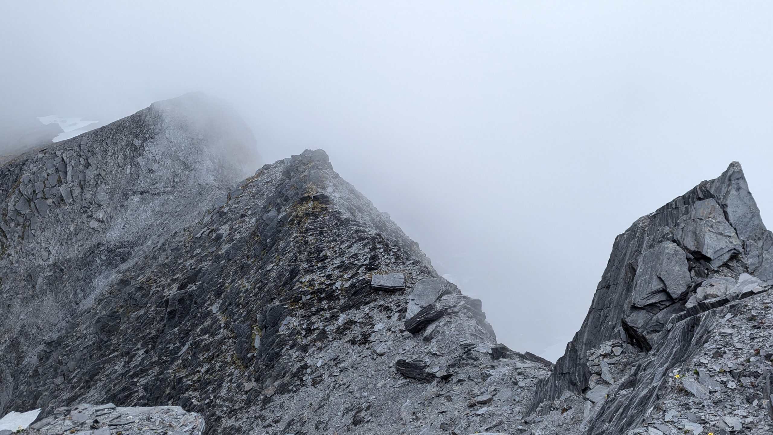
Just beyond Point 2084 was the next significant obstacle. A narrow steep sided arête covered in snow, easy enough to walk along, but no stopping in the event of a slide. Again, technically easy but high consequence, it’s probably possible to sidle around below this point, but with the exposed section only being about 10m long, I decided it was fairly low risk.
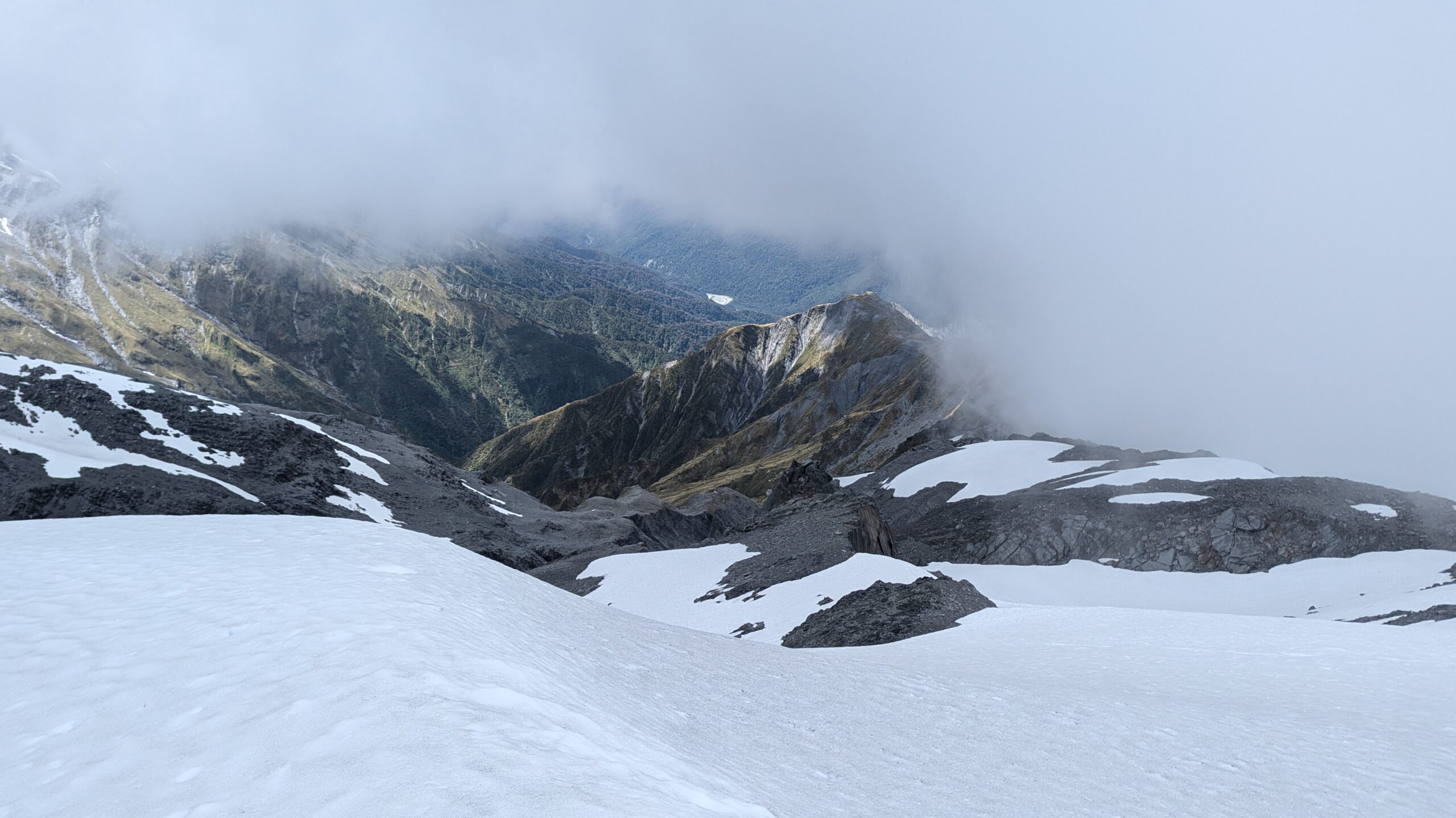
Onto the final stretch of the alpine crossing, and Ivory Lake can now be seen down below. The clouds roll back in and visibility plunges.
It’s now 7:30pm.
In an effort to avoid unnecessarily climbing a knoll I try to sidle around. In the low visibility I mistakenly pick up the wrong spur which descends towards the lake too early. As it starts getting steeper I realise my mistake, but am fairly confident I can see a route down to the lake from here so decide to commit. It gets steep… like real steep.
For any solo trip where you’re expecting steep and scrambly terrain a critical piece of gear is a short length of rope or tape for lowering your pack. I’d been fully intending to bring some, but in the rush had completely forgotten. Had I remembered, the following incident could have been avoided.
Arriving at a challenging looking 2 meter downclimb, I decide to lower my pack. All I’ve got to do this is my arm, which is significantly shorter than 2 meters. I lower my pack as far as I can and drop it the last little bit. With the benefit of hindsight (or let’s be real, some common sense in the moment) it’s obvious that this wasn’t going to work. The gradient was close to 45°, so predictably my pack starts tumbling down the hill.
Only it doesn’t stop.
Off a cliff, and it’s out of sight, but I can still hear it rolling.
Please stop before the lake…
Please don’t stop on some inaccessible halfway ledge.
After rapidly descending 100 meters the pack does come to a stop, I eventually reach it and assess the damage.
- Hydration bladder: cracked mouthpiece now has a slow and steady leak
- E-reader: cracked screen, non-functional, now a dead-weight
- Jetboil: dented, and no longer locks together properly
- Backpack: Broken strap and a bent frame that digs into your back whilst wearing. Hopefully I can fix this one, because it’s a three day walkout from here no matter which way you go.
- Water bottle: missing
- Hiking poles: missing
- Apples, chocolate, and muesli bars: Pulverised
It’s getting dark and I’m almost at the hut, I can see it silhouetted through the mist. Searching for my missing poles and water bottle can be a tomorrow problem.

The steep-sided snow-covered arete
Where my pack finally came to rest
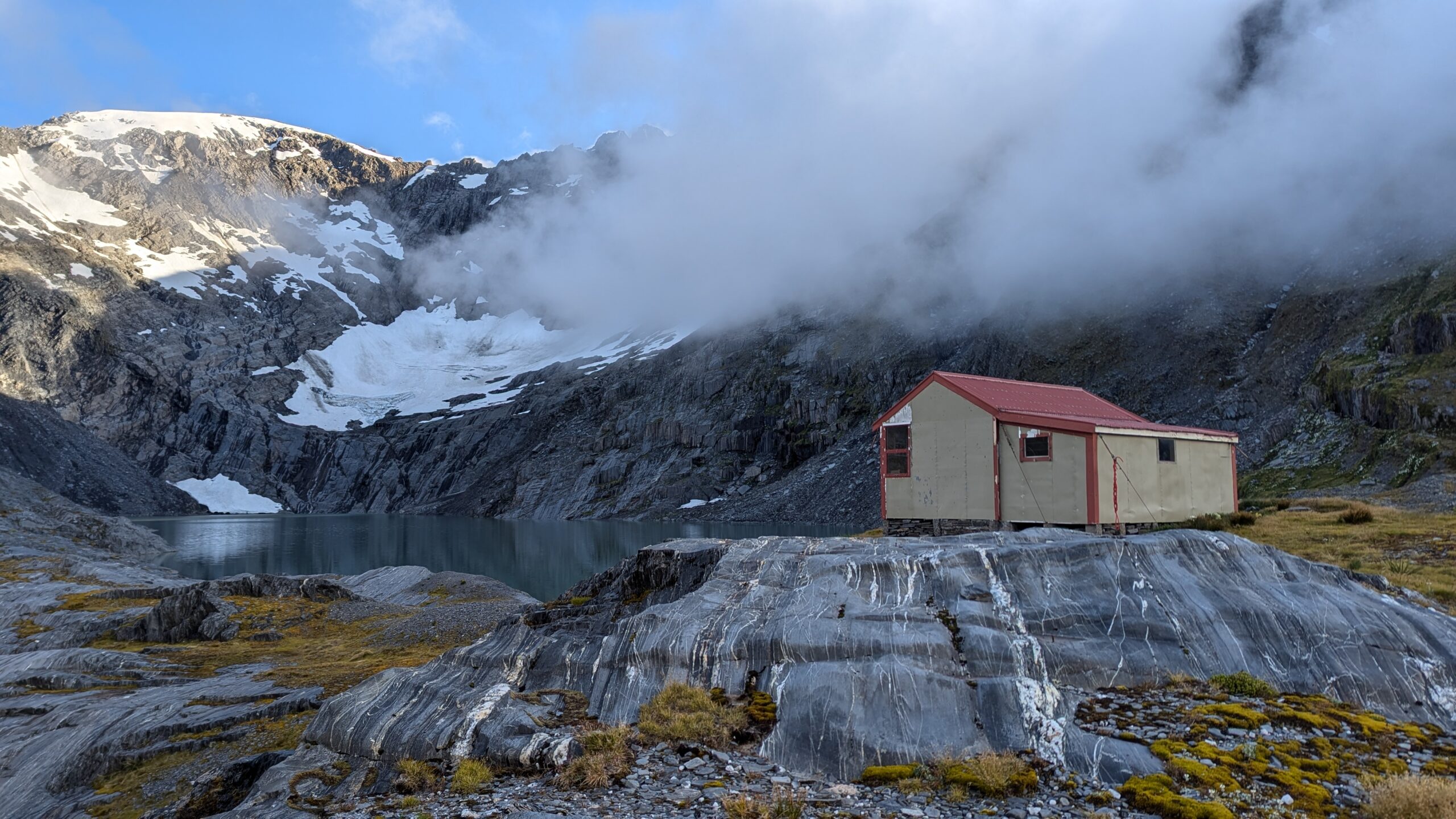
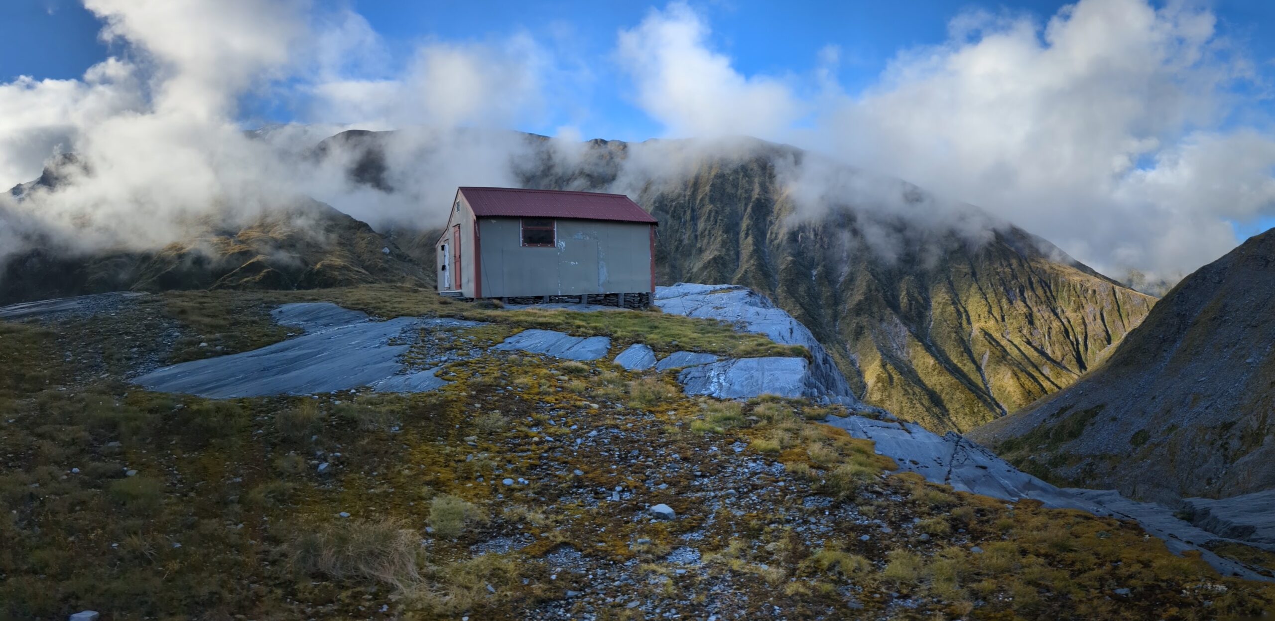
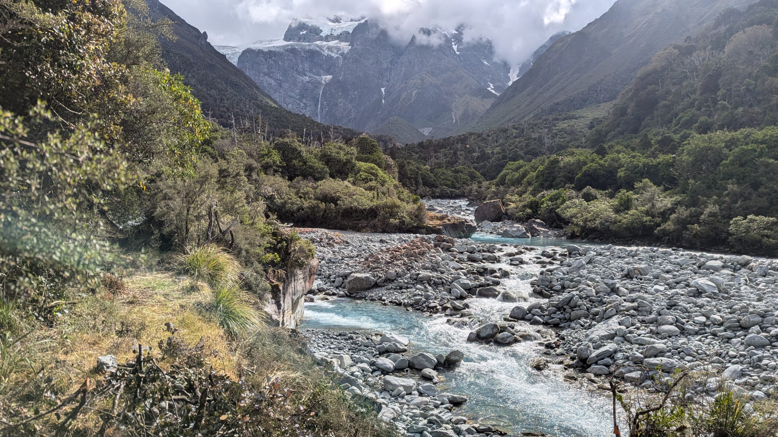
Ivory Lake Hut in the mist
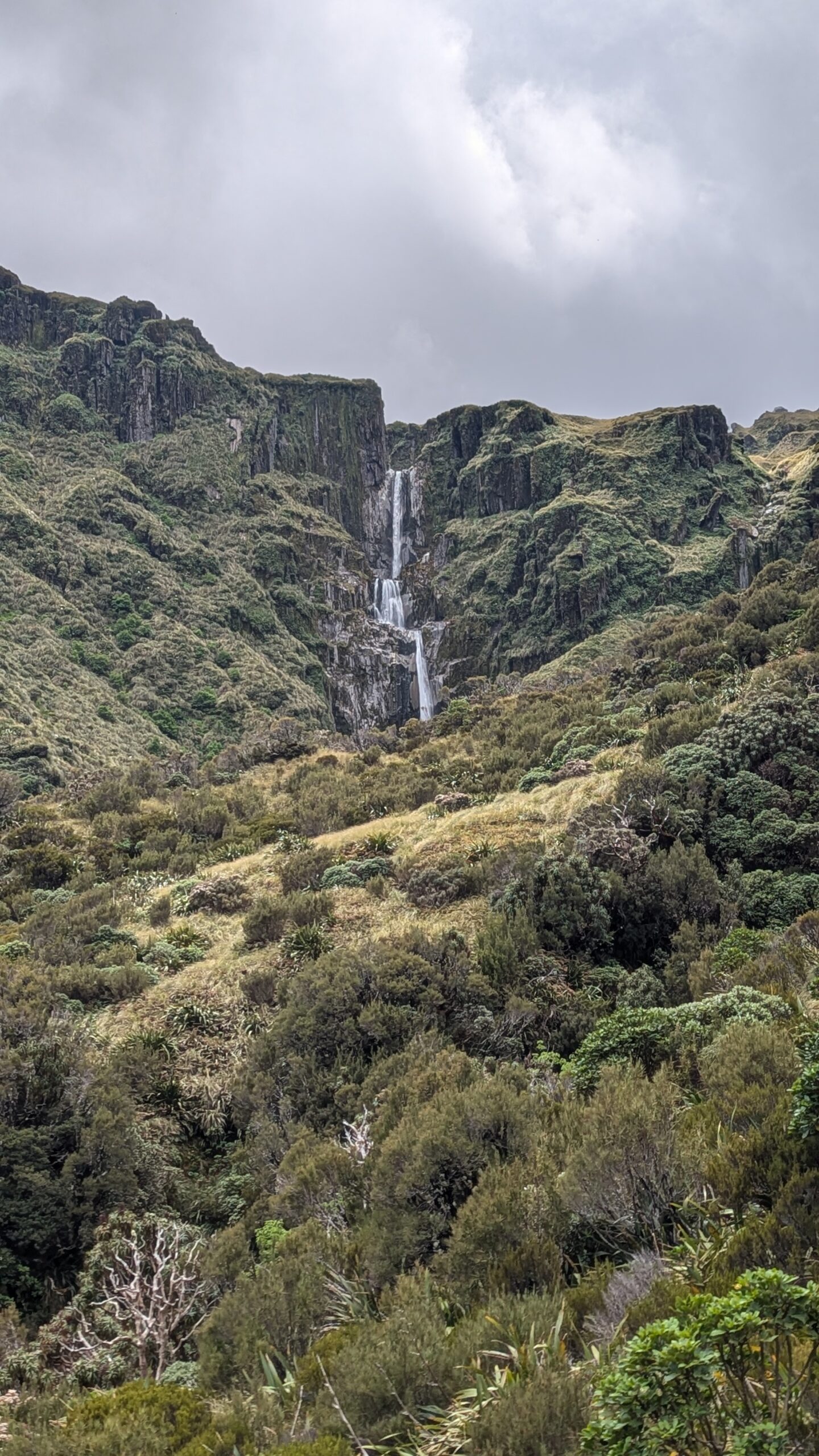
Ivory Lake Hut certainly lived up to its reputation, perched precariously on a cliff top overlooking the headwaters of the mighty Waitaha River. Peer out one window and you’d see the outflow of the lake, as it plunges down several cascades into Stag Creek. Peer out another window to see the lake itself, ringed by jagged peaks, and fed by a remnant glacier clinging desperately to the cliff faces above. A true victim of climate change, this glacier is sadly a shadow of its former self.
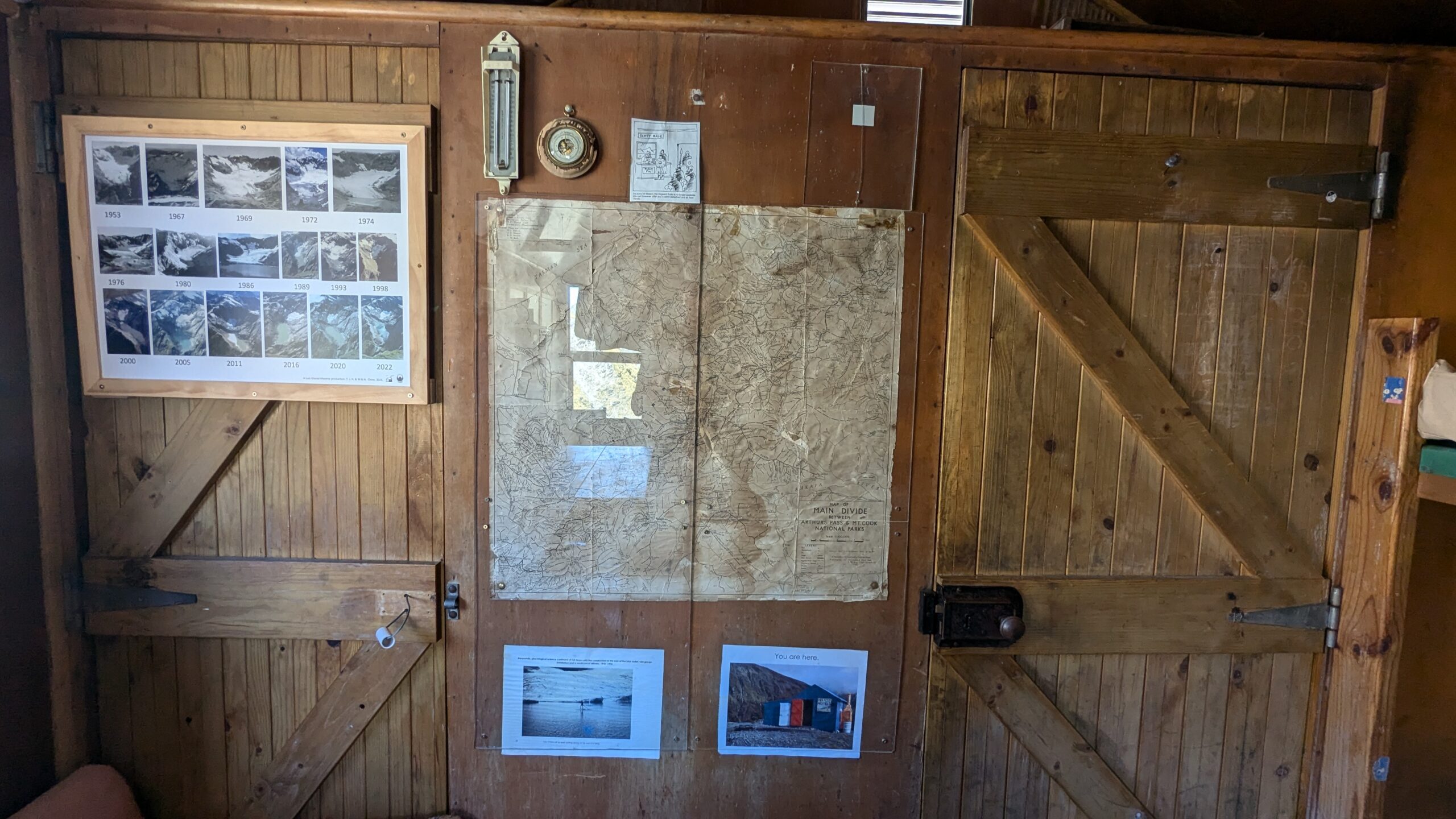
Built in 1970 as a research base for glaciologists, the hut walls are lined with historical photographs and other items of antiquity.
Beneath the bunks are a couple of storage crates filled with food. Supply drops that people have flown in, in preparation for some epic sounding expeditions. The Southern Alps Traverse, essentially a hard-core version of the Te Araroa trail.
Slinging my backpack over a ceiling rafter I hang off either end and with a few bounces am able to straighten the frame close enough to its original state.
I had the hut to myself that night.
Only in NZ have I experienced this contradictory feeling of being in pure isolated wilderness, while also having four walls, a roof and a thick foam mattress to sleep on.
Ivory Lake Hut is currently sitting in position number one on my list of “favourite places I’ve slept”.
Ivory Lake Hut
Day 4: Ivory Lake Hut to Price Basin Hut – 5km
Today was almost a rest day. Yes, there would be another big ascent up and over the Lange Range to reach Price Basin Hut, but it was only 5km all up.
After a bit of a sleep in I woke up to beautiful sunny weather, and treated myself to a swim in the lake, which was surprisingly not freezing. The distant rumbling of a helicopter emanates from down valley.
When I’m out in the Australian bush and hear a chopper, my first thought is always that someone needs rescuing.
Not the case out here.
The majority of helicopters seem to be chartered. It’s not uncommon to hear of kayakers, hunters, trampers, or mountaineers getting themselves and their equipment flown into remote huts, and then of course there are tourists on scenic joy flights.
The chopper soon emerges and does a close-to-the-ground lap around the cirque. Standing outside watching it, I imagine I’m part of an uncontacted tribe. I see the passengers staring back, and think to myself that with a good enough spear I could probably take it down.
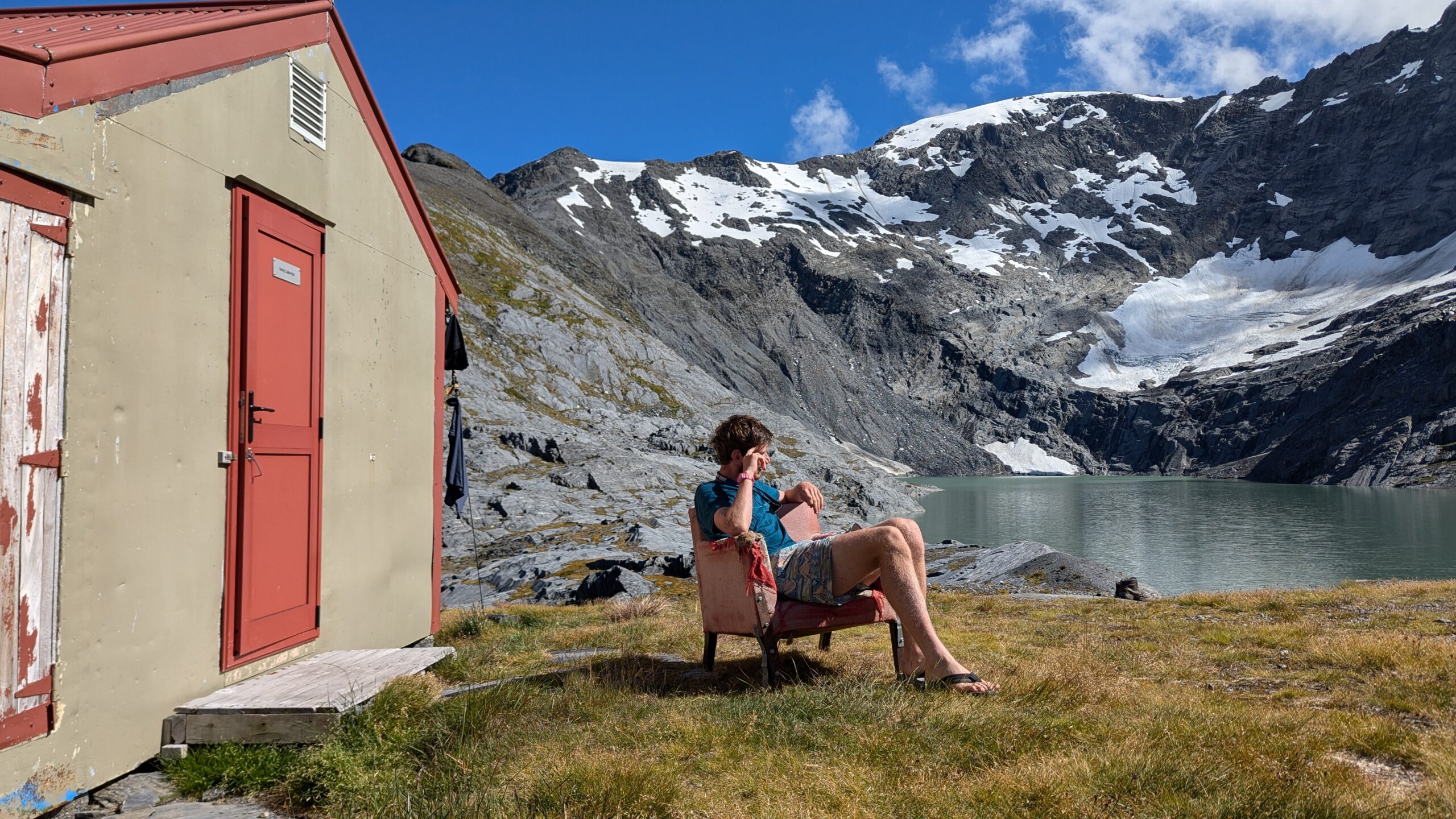
Next up is a quick photo shoot with “The Armchair of Glaciology”. This chair has been here since the 70’s and can be seen in many of the historic photos plastered around the hut. Fifty years later it’s looking a little worse for wear, with springs poking out the seat cushion, and the legs secured with retrofitted steel plates.
The Armchair of Glaciology
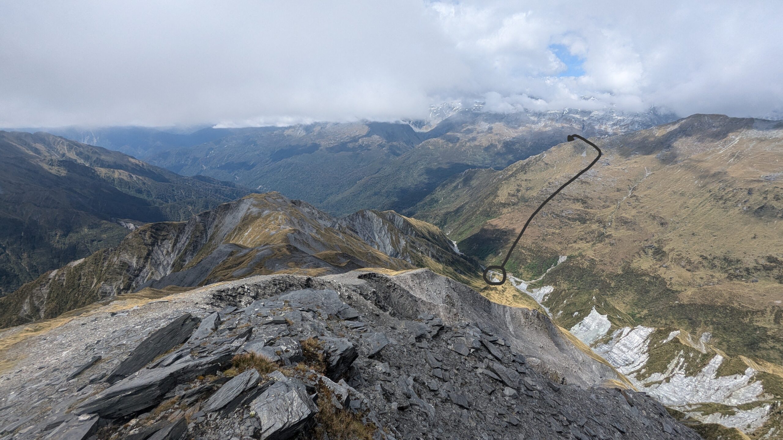
The final job of the morning is to return to the site where my backpack fell. Once there, I scramble up a ledge and manage to find my missing water bottle and hiking poles.
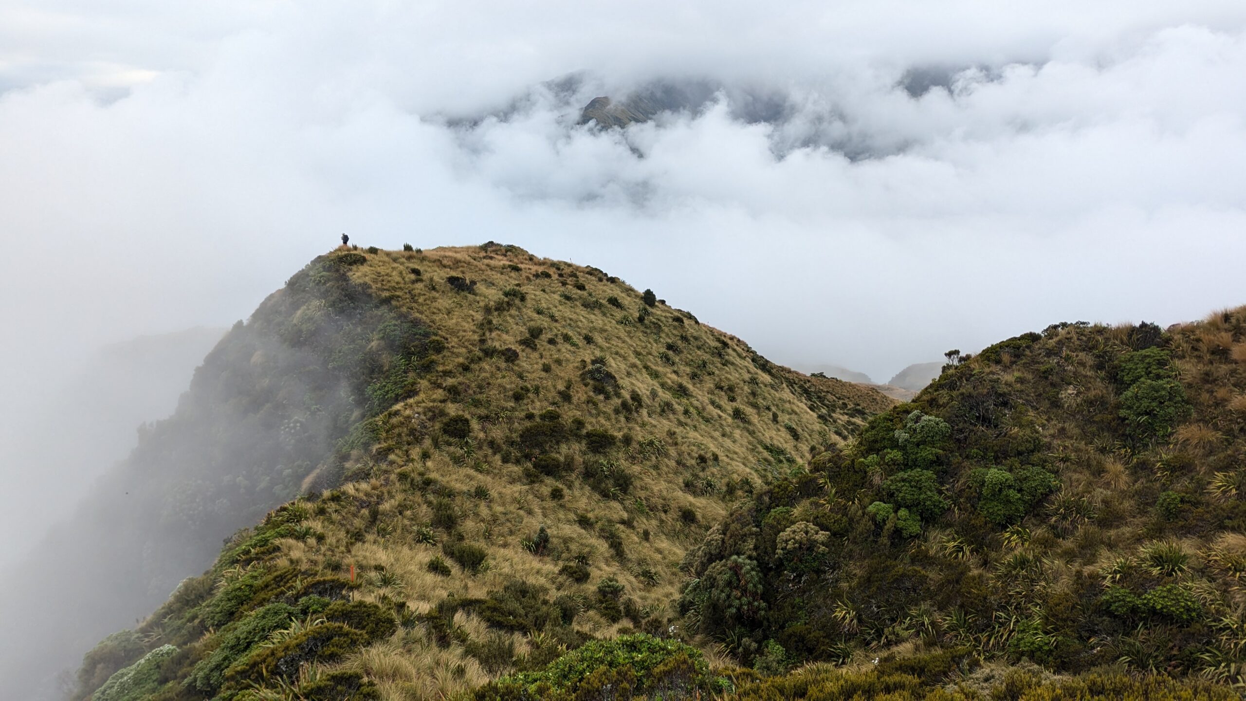
The climb up to the Lange Range is steep but easier than expected. Back on the tops there were some great opportunities for glissading down snow slopes. It can be so motivating to gain a bit of speed.
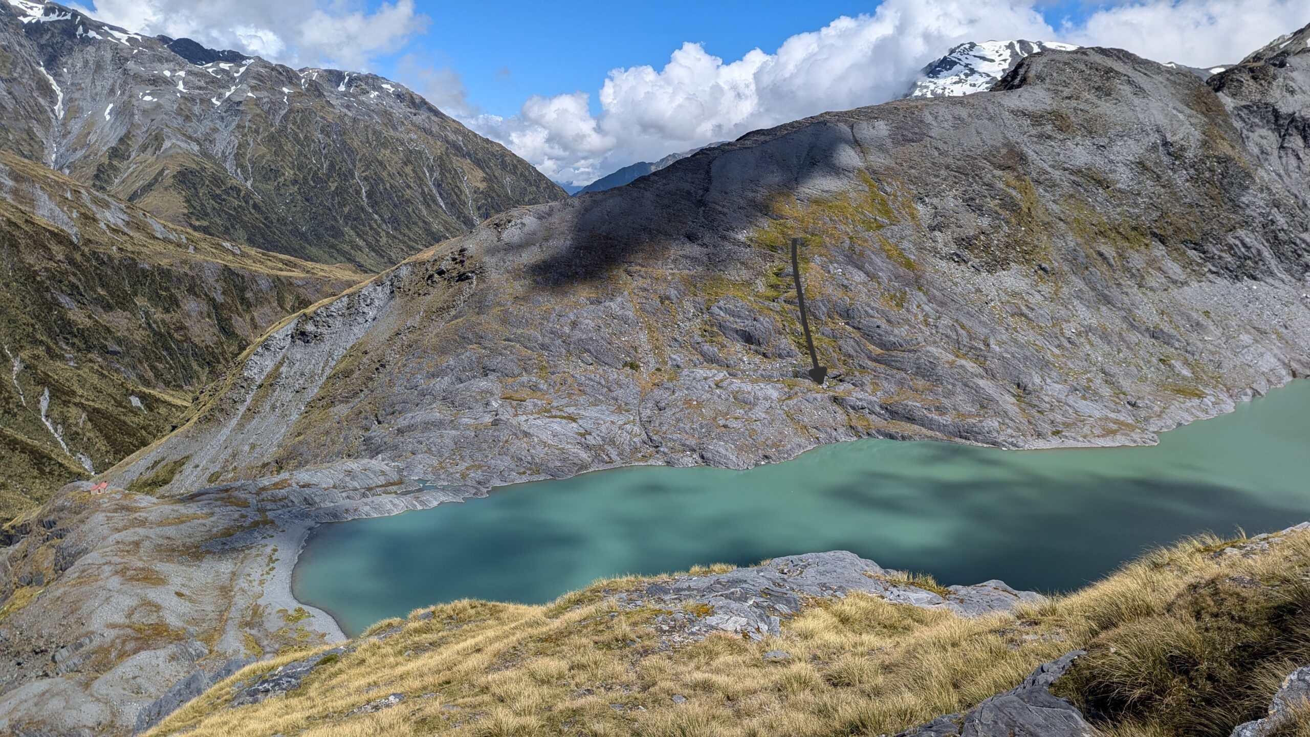
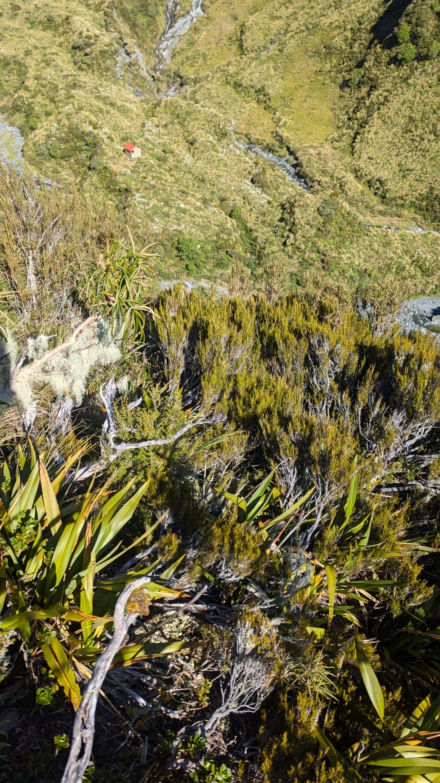
The arrow shows the descent path of my pack. Ivory Lake Hut can still be seen on the left
The Lange Range
Glissading was an efficient form of travel up here
I also saw an endangered Rock Wren. These birds spend their entire lives hopping among boulders above the tree line, and as a result have lost their tail. Their resemblance to a tennis ball makes them easy to identify.
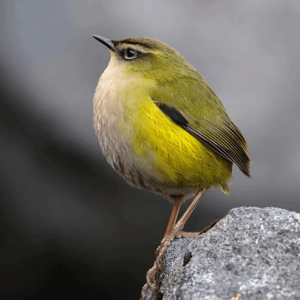
A New Zealand Rock Wren (Not my photo)
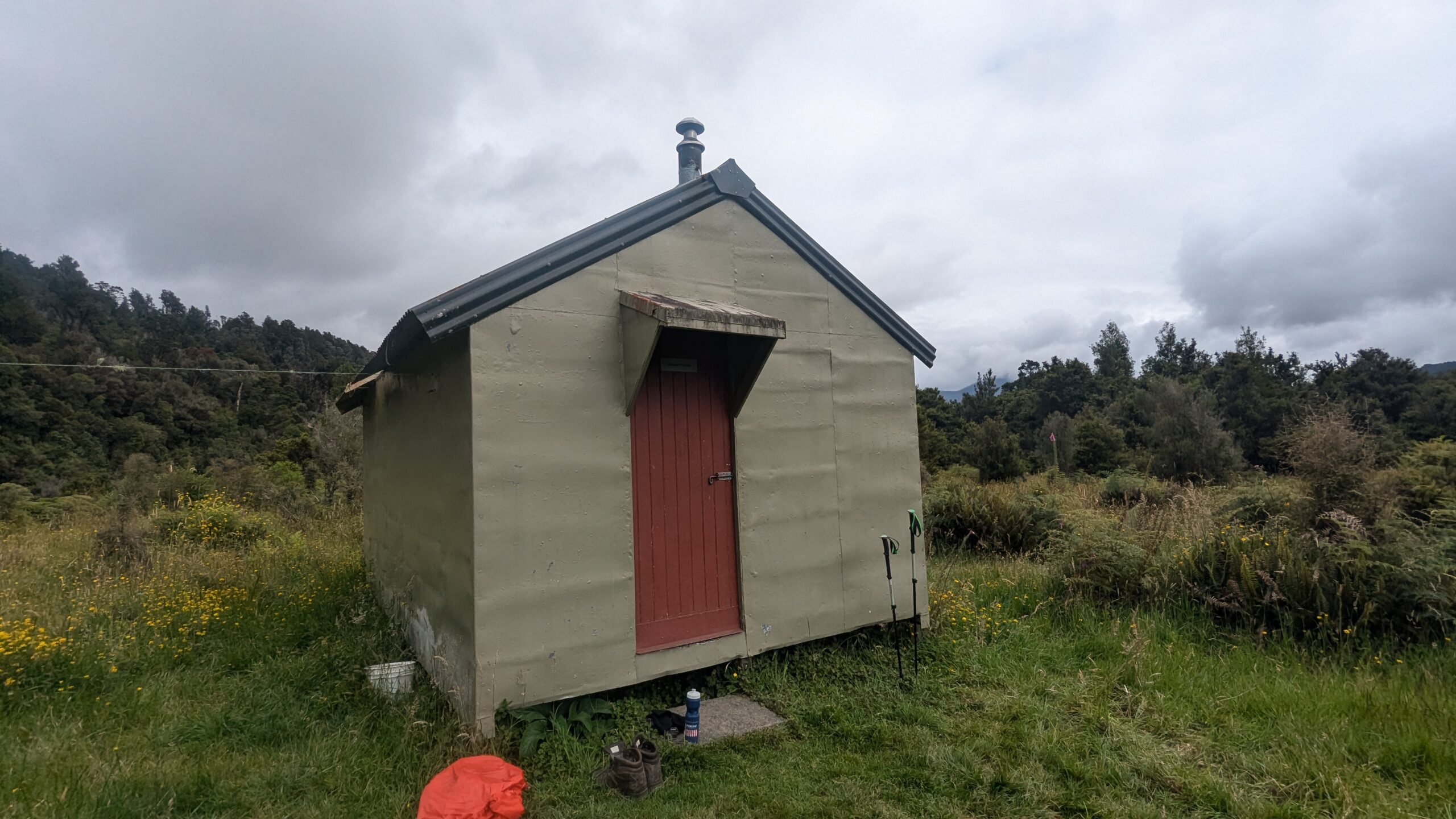
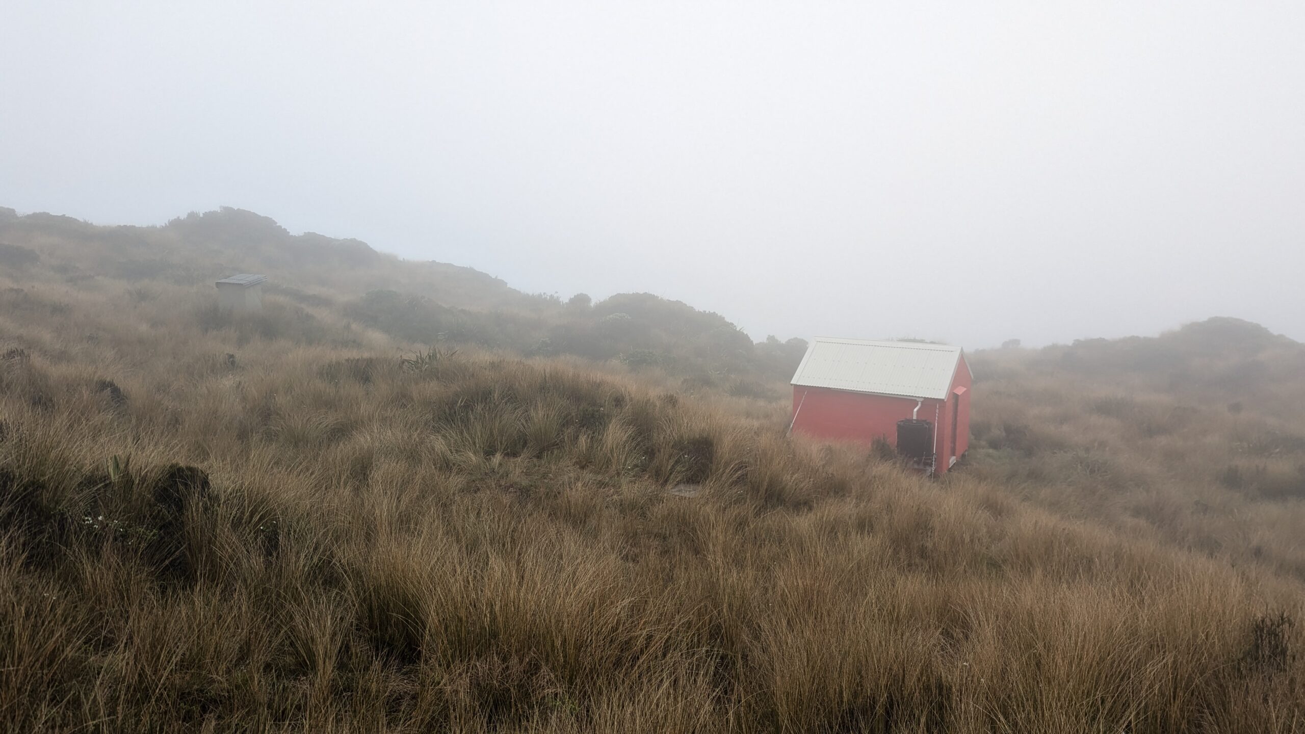
Back down in the valley now, I tread delicately through a field of Spaniards into the welcoming embrace of Price Basin Hut. Of all the huts I stayed at, this one had the lowest visitation. Maybe four or five parties a year and most of those were hunters who got choppered in. I set my boots out to dry in the sun, a rare sight in this valley, according to the entries in the hut book.
With my e-reader broken I perused the huts reading material, finding a copy of the “NZ Hunter Magazine”. As someone who’s had literally zero exposure to any form of hunting or firearms, I found this magazine genuinely interesting. It was bizarre seeing full page advertisements for the latest and greatest rifles and laser sights. One article complete with pictures was titled “How to Gut a Deer”, “Step 1: Cut a ring around the anus, completely freeing the rectum”. I suppose that makes sense doesn’t it, I don’t really know what I was expecting?
Price Basin Hut is circled. The arrow shows tomorrow’s route over Pahlow Ridge. In hindsight I should have used the creek to the right of this arrow to ascend past the scrub
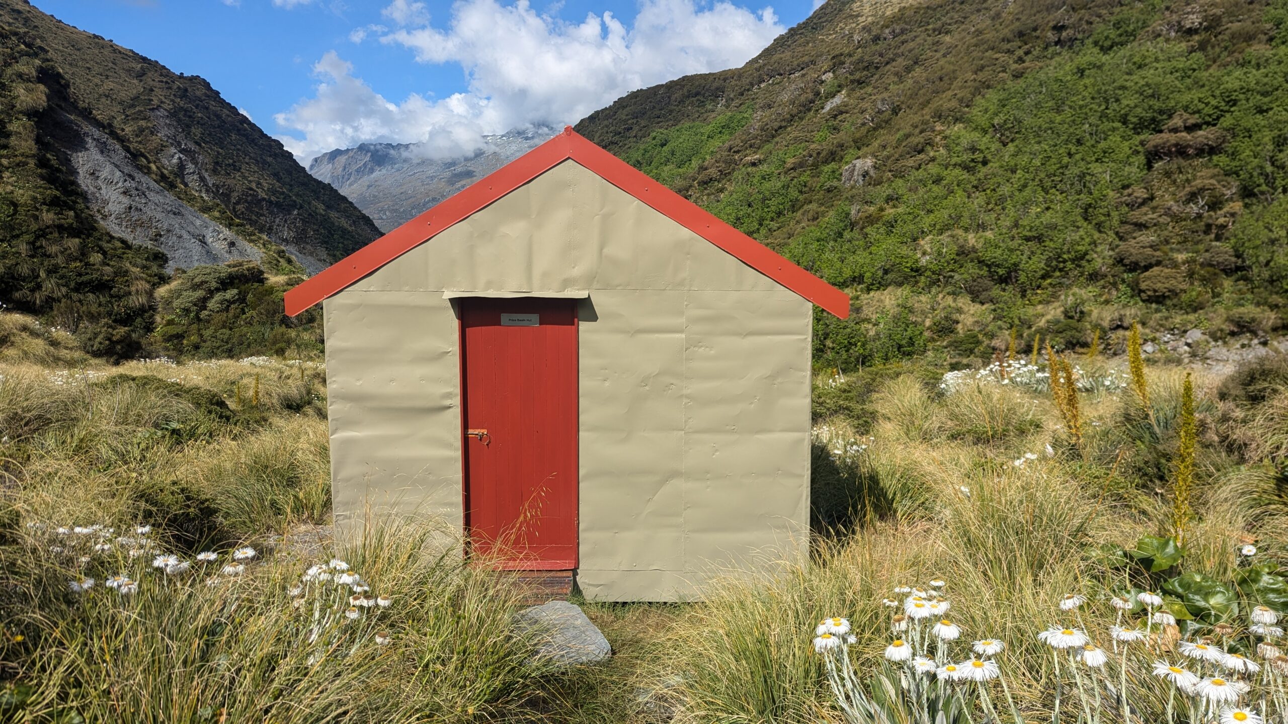
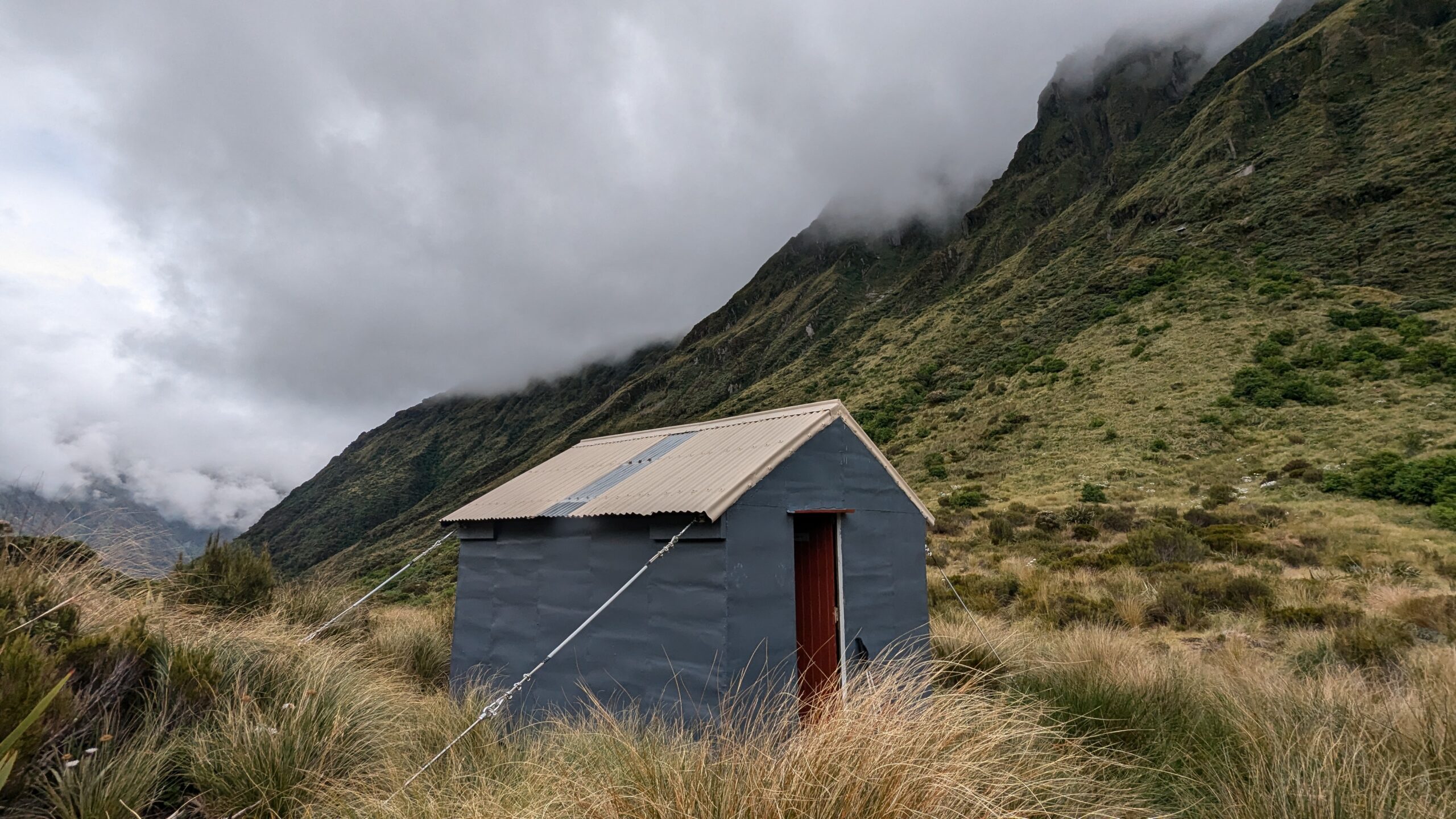
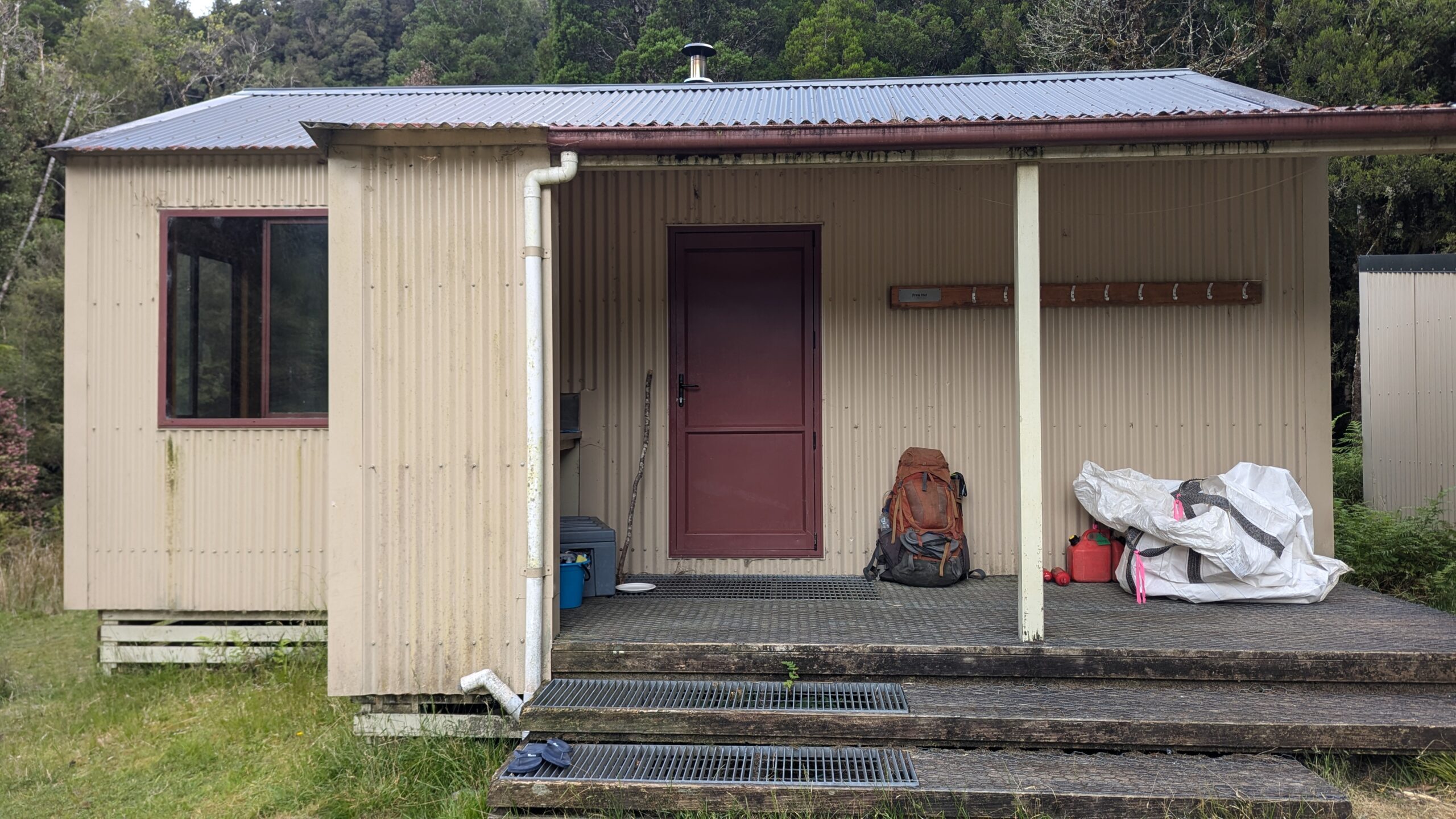
Price Basin Hut
Day 5: Price Basin Hut to Wilkinson Hut via Neave Hut – 10km
There’s a recent looking entry in the hutbook from some Permolat volunteers. “We spent today clearing the route to Wilkinson Hut. The track is now in great condition”. Amazing news! I think, only to see that the entry is now five years old. Hopefully there’s still some semblance of a trail.
Today’s walk was another big ascent up and over Pahlow Ridge, then back down to the Whitcombe River which I’d follow upstream to Wilkinson Hut. It was only 6km so if time allowed I’d do a quick side trip to Neave Hut as well.
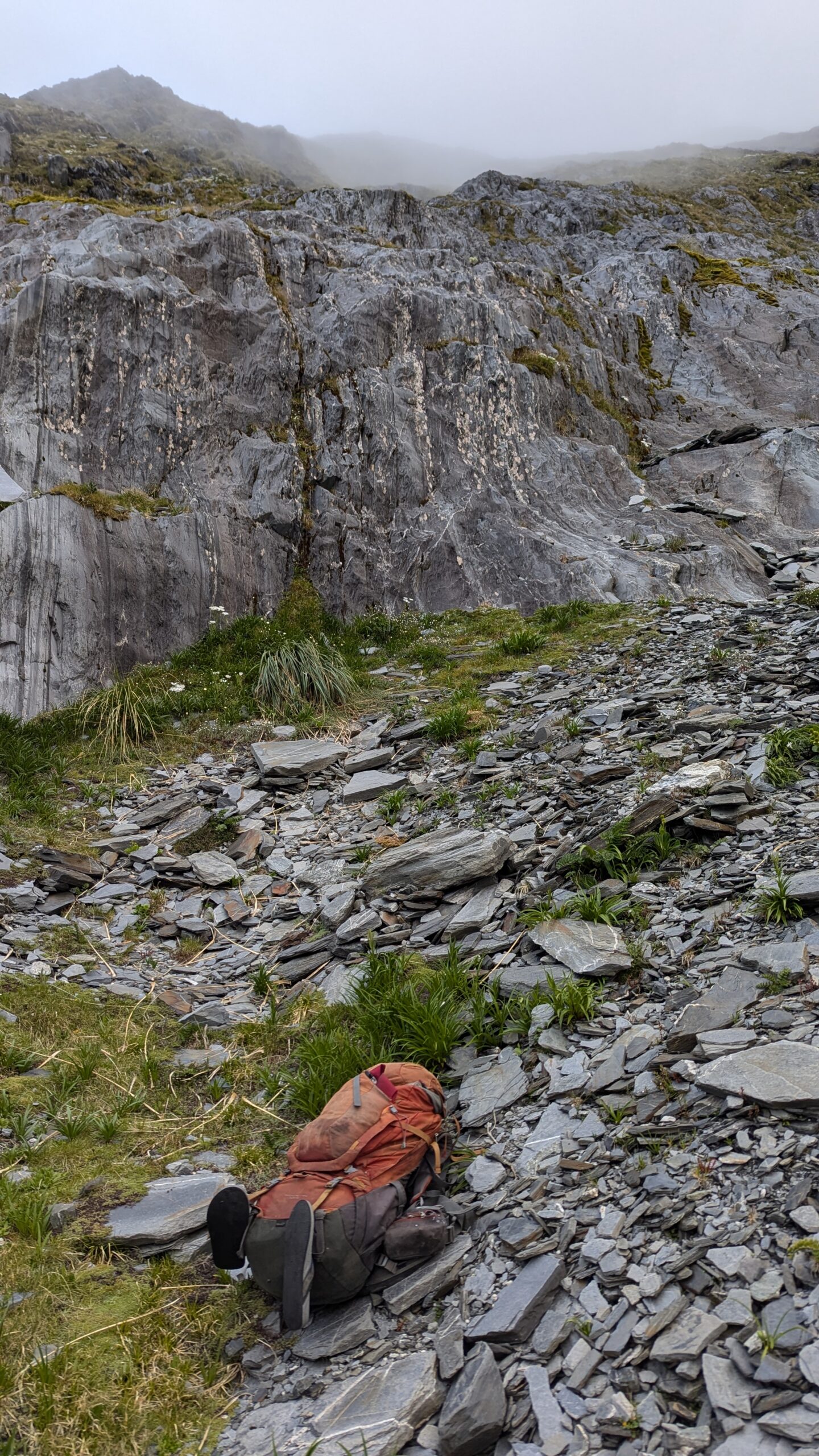
Separating Price Basin Hut from the tussocks on Pahlow Ridge is a 100-200 meter band of dense alpine scrub. I searched up and down the riverbank where the route was marked on my map, looking for any sort of track, but found nothing. With no other options, I selected what looked like the path of least resistance, and dove straight into what would be the slowest scrub bash of my life. In some sections I was laying on the ground crawling between gnarled tree trunks while pushing my pack in front of me. At other points I’d be climbing through the tree tops, traversing tens of meters without ever touching the ground. After one hour of this I turned around to see that Price Basin Hut was still only a hundred meters behind me.
Had I done a little more research pre-trip this scrub bash could have been easily avoided. The Remote Huts website is an incredibly useful resource with extensive info on many of the West Coast huts, including this line regarding access to Price Basin “A band of scrub on the last 100m before the river can be avoided by heading upriver a bit and dropping down the side-creek that drains Mt. Van Redan. Allow at least 8 hours from Wilkinson Hut to Price Basin Hut.”
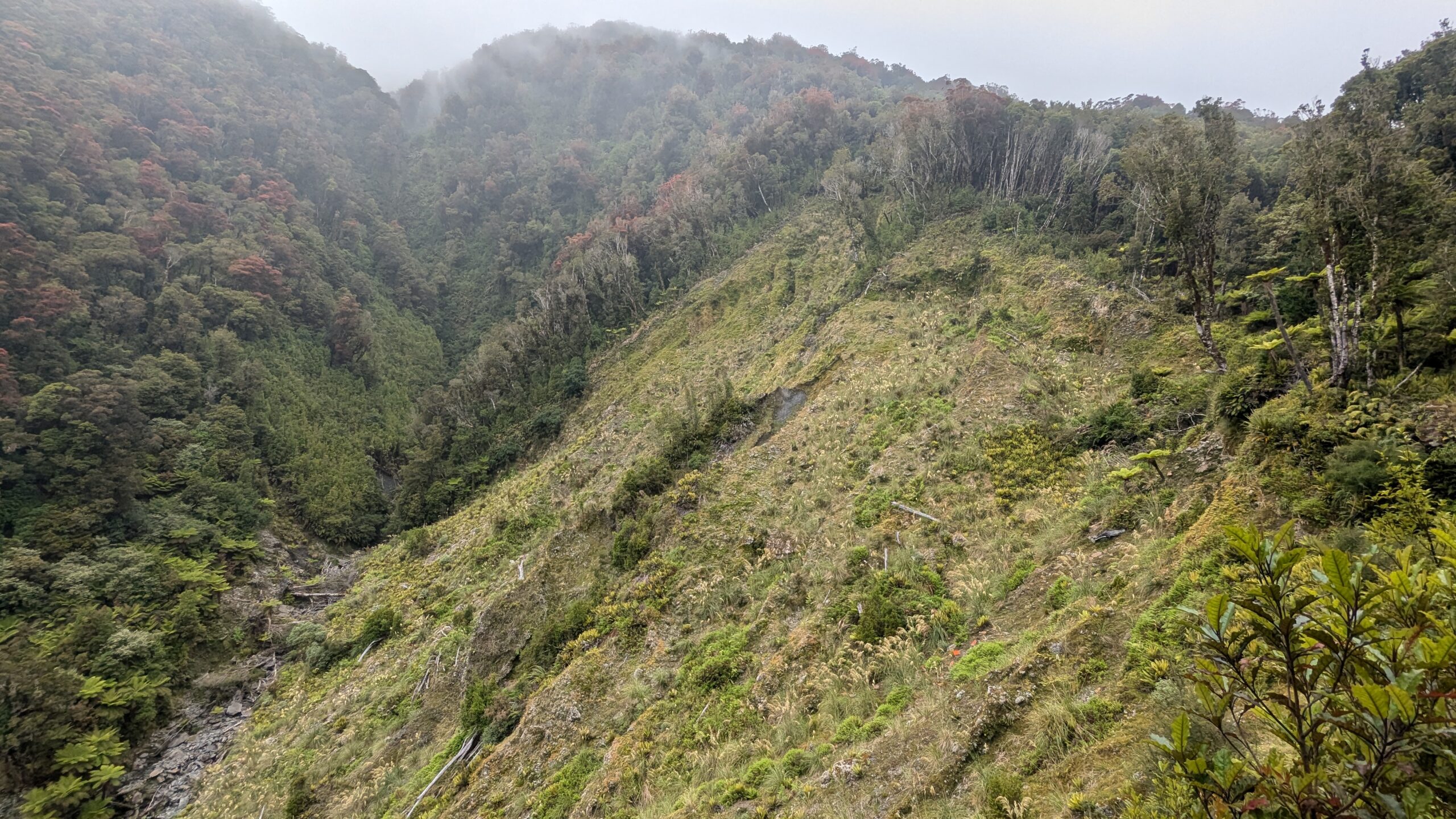
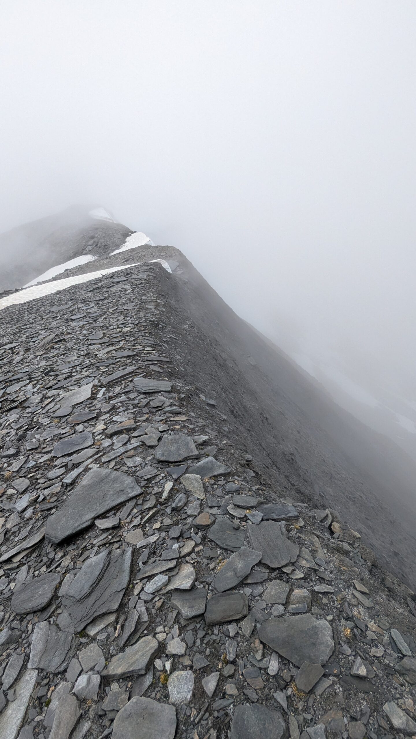
I eventually broke through the scrub and into the tussocks. At last, back to some straightforward hill climbing. You’ve got to be careful where you hit the top of Pahlow Ridge, the route shown on the topo is pretty accurate. I hit it slightly too high and had to do some steep sidling around bluffs to regain the mapped route. There was a small amount of reception up here.
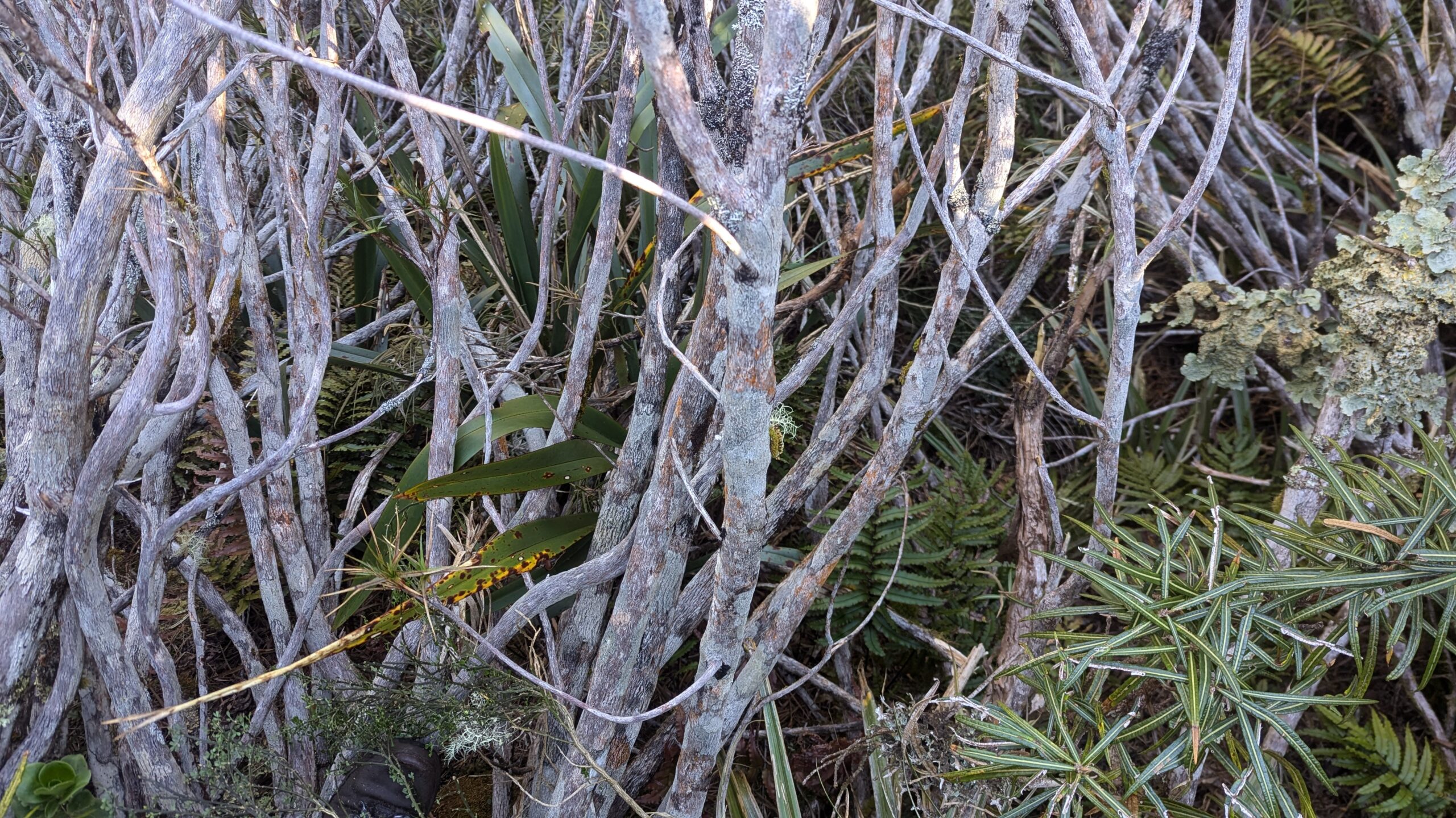
Not easy pushing through this scrub
After one hour, I’ve barely made it 100m past the hut
I crested Pahlow Ridge too high up, but at least there were good views
Spaniards as far as the eye can see. One of many reasons why today was so slow
The route down to the Whitcombe follows a steep rocky creek bed literally the whole way. At one point you hit an impassable looking waterfall. I spent quite some time figuring out how to get down here, before finding a small hole on the river left that I could squeeze through. This hole takes you down through a slippery boulder cave and directly under the waterfall. A pretty neat little pass, but challenging with a pack, and you will get wet. I think most people just go through the bush at this point.
Some more easy creek walking and I’m spat out on the true left bank of the Whitcombe River. There’s an official DOC walking trail on the right hand bank which would allow fast and easy travel to Wilkinson Hut. The river was certainly not crossable at this point though and looking at the flow I suspect it would only be crossable at bridges. I ended up boulder hopping the left bank most of the way up to Wilkinson before finding a blazed trail.
After taking 8 hours to travel 6km, I wasn’t really in the mood for a side trip out to Neave Hut and back, solely for the sake of hut bagging. An entry in the Wilkinson hut book convinced me otherwise. Just one day ago a team of DOC workers and Permolat volunteers had been up here and re-cut the 2km of trail out to Neave.
I’ve got to say they did an amazing job; it was so refreshing to be back on a proper trail. The journey out to Neave Hut and back was fast and easy.
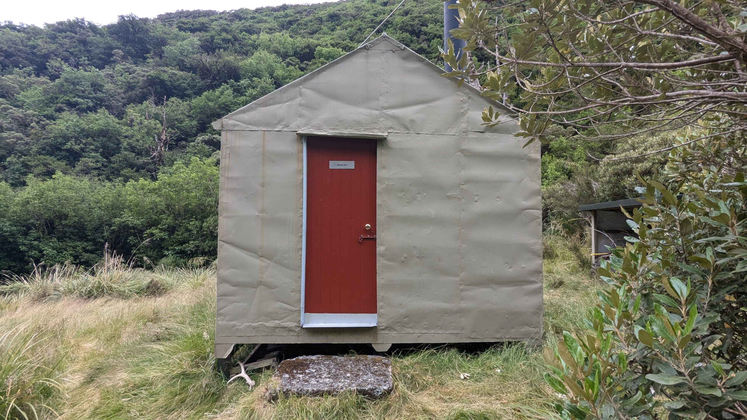
Neave Hut
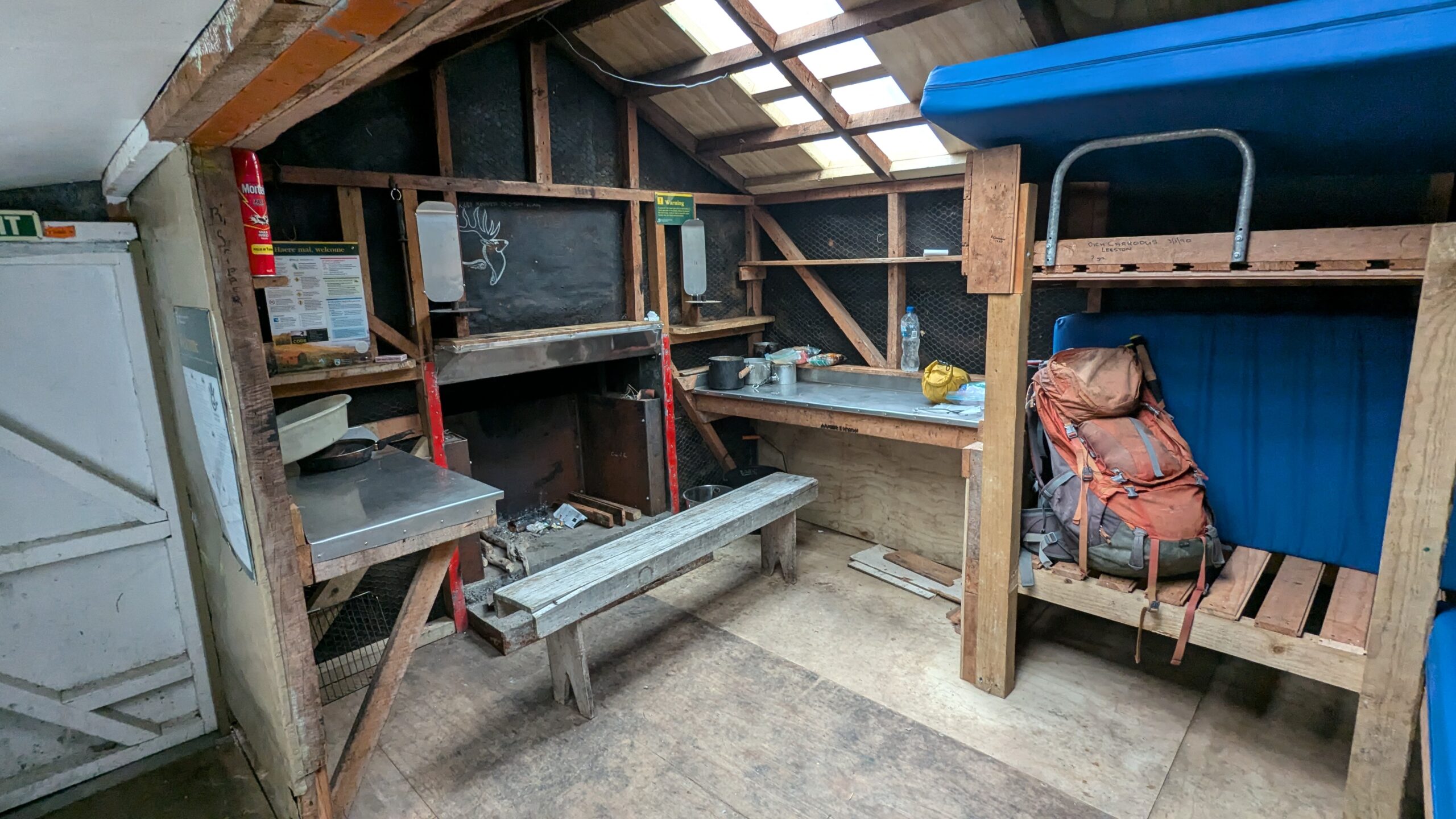
Wilkinson Hut
Day 6: Wilkinson Hut to Rapid Creek Hut – 21km
Distance wise, this was by far the longest day, but I was back on an official trail now and there were no more significant hills. The next two days I would be following the river all the way back to Hokitika Gorge. For the most part the trail took you well above the river along the steep-sided valley wall. Between Price Flat Hut and Meridian Creek there were countless landslides, many of them recent. These were slow to negotiate, and it was often challenging to pick up the trail on the other side. If this trail were in NSW, I’m certain that NPWS would have closed it for safety reasons. Over here, the DOC workers had simply written a warning in the hut book. No need to close the trail, just provide people with the necessary information for them to make their own risk assement. Just the way it should be when it comes to environmental hazards.
It had been four days now since I’d seen another person which I think is a personal record? It’s only natural in these situations to start talking to yourself, sometimes verging on a full blown conversation. Occasionally, when I look back on these conversations I’m not sure if I was talking out loud, or in my head. This was the case when three DOC workers rounded the corner.
Was I just talking out loud?
Could they hear me approaching?
Do they think I’m a crazy person now?
Historic Price Flat Hut
Frew Hut
Across the Collier Gorge Swing Bridge and soon enough I’m at Rapid Creek Hut. The sandflies here are bad. I race inside, and to my horror see that the walls and ceiling are also crawling with sandflies… only they’re not actually crawling. I wipe my hand across the ceiling; unsticking the dead sandflies from their resting place, and watching them fall to the floor. Thank god.
If you’re not familiar with the New Zealand Sandfly consider yourself lucky. Here’s a bit of backstory.
Many years ago the Maori god Tu-te-raki-whanoa sculpted the mountains and sounds of Fiordland. This landscape was his masterpiece, so beautiful that people would travel to Fiordland and never want to leave. Hine-nui-te-po, the goddess of death didn’t like this, she created the sandfly, releasing them throughout Fiordland to chase away the visitors, and to get the unproductive people moving again.
When the sandflies are out it can be borderline impossible to stand still outside. They come in swarms and are attracted to heat, so will latch onto any exposed skin. Ankles are a favourite. The bites are itchier than a mozzie and last for days. I learned all this first hand while walking the Dusky Track last year.
At times like these, the NZ hut network is an absolute blessing.
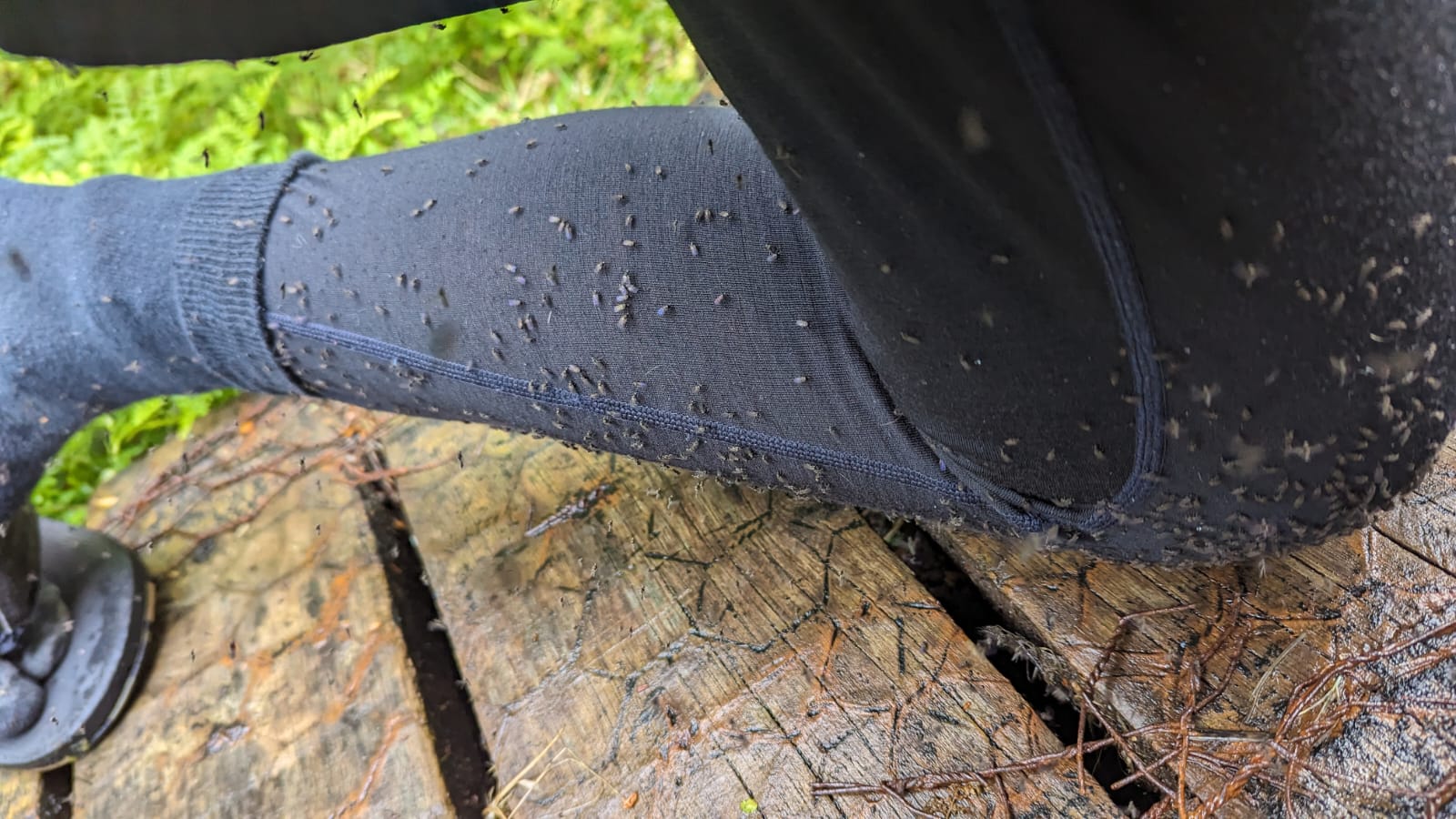
Sandflies on the Dusky Track in 2023
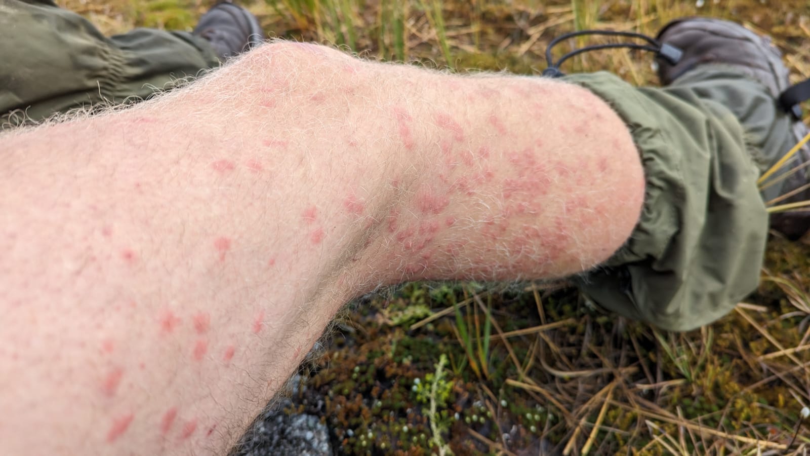
The aftermath
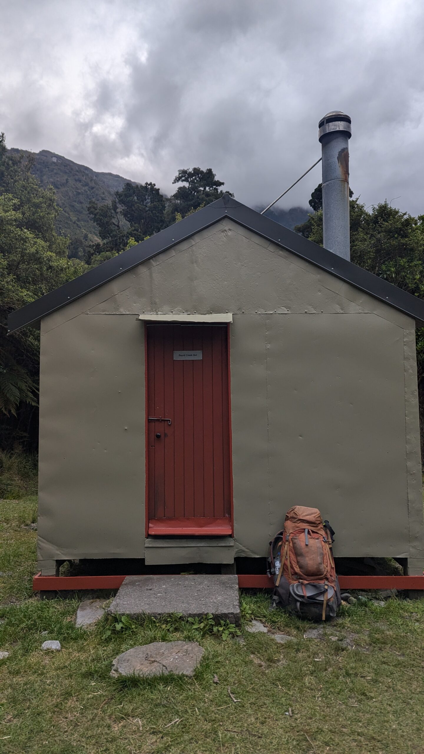
Rapid Creek Hut, the final hut of the trip
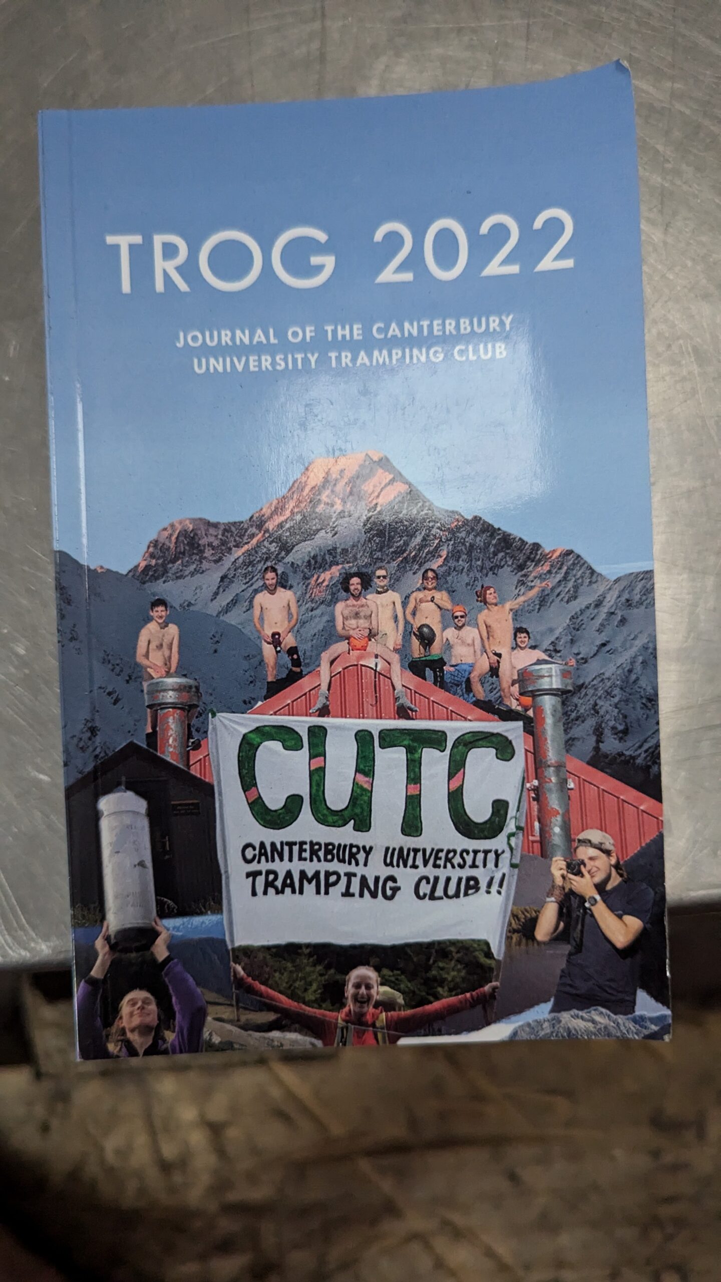
Inside the hut was a copy of the TROG. The book that had inspired this journey
Day 7: Rapid Creek Hut to Hokitika Gorge – 9km
Not far to go now!
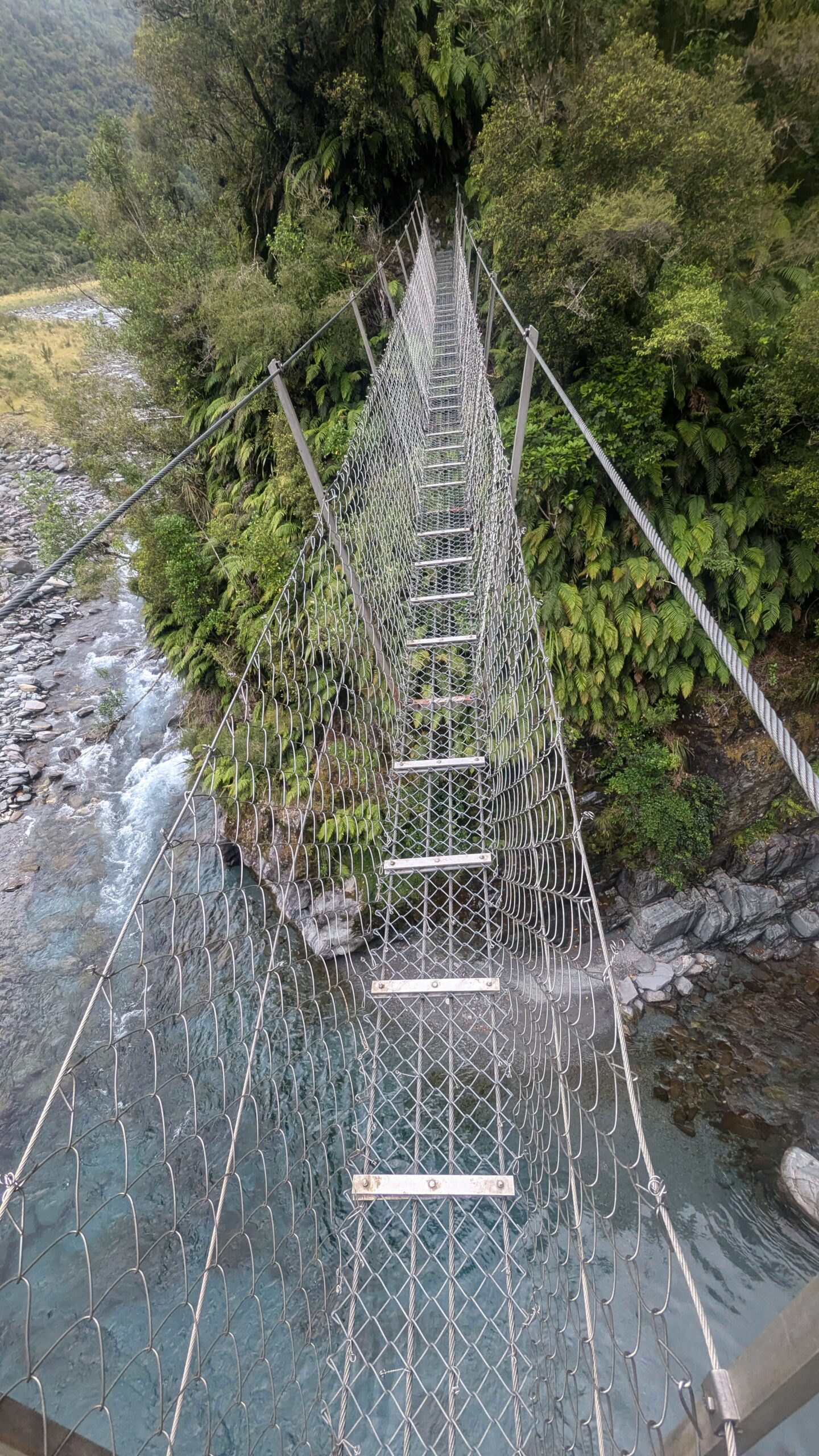
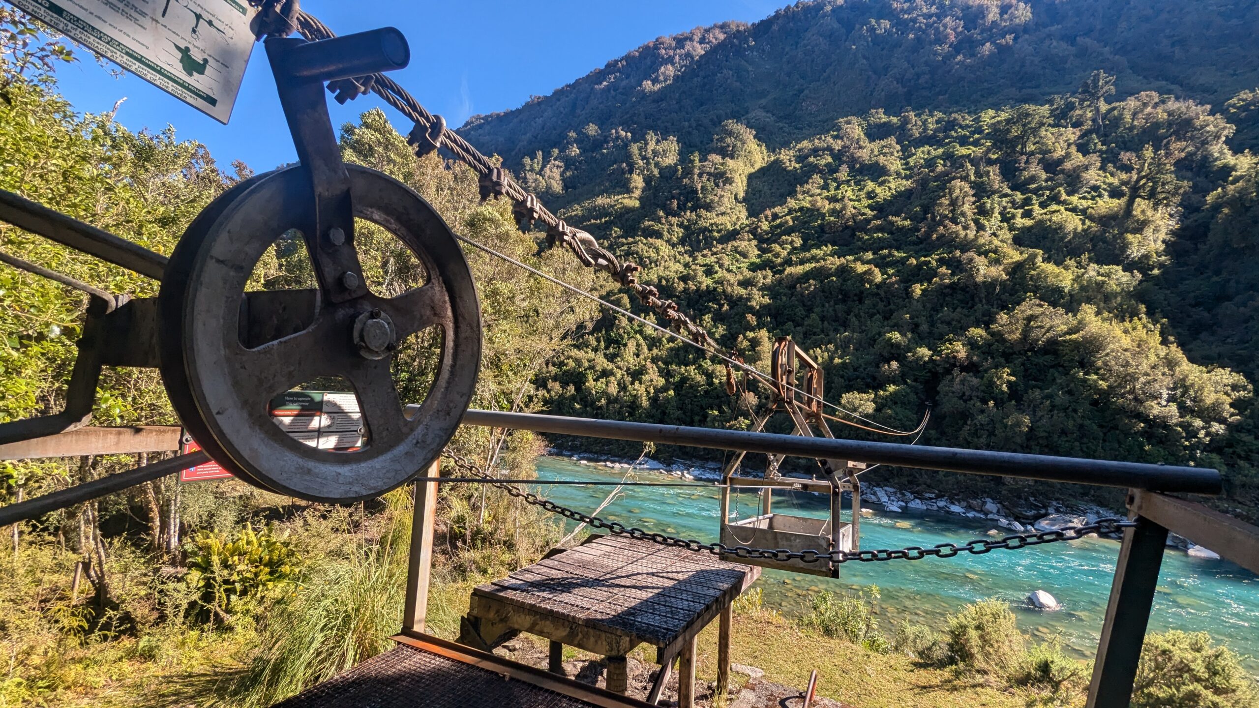
The cableway crossing was a highlight of today. I winched the basket over to my side of the river climbed inside, and zip-lined down to the low point at the centre of the cable. These cableways are more designed for group crossings. A winch at either end allows someone on the bank to move the basket back and forth across the river, transporting one person at a time. For solo crossings a special tool is provided. Similar to a pipe wrench it clamps onto the cable and gives you some leverage to pull yourself across to the other side, while also locking in place if the basket tries to roll back to the low point. Trying to pull yourself across without this tool would be a recipe for lost fingers.
Easy travel from here along the banks of the Hokitika River, a few kilometres of dirt road, and I’m back where I started, in the hustle and bustle of Hokitika Gorge carpark. What a contrast after 7 days of solitude.
My bag of canyoning equipment is fortunately still stashed in the bush where I left it. Next up is a swim at Hoki Gorge Beach to freshen up. There’s a great jump rock here as well.
All in all, this was a bucket list trip that certainly lived up to expectations. I was after a challenge, and the wild west coast delivered. I can only imagine how much more challenging this trip would have been, had I not been so fortunate with the weather.
As I’m walking back to the carpark, I cross my fingers and hope that someone here will pick up a dishevelled looking tramper that hasn’t showered for 12 days; I’ve got a plane to catch.
The cableway across the Hokitika River